Mapping Asia’s Biggest Copper Mine Using a UAV
In early May 2018, the Czech company UpVision used an unmanned aerial vehicle (UAV) to map a copper mine in Mongolia – the largest in Asia – as part of an ongoing Czech geological expedition at th...
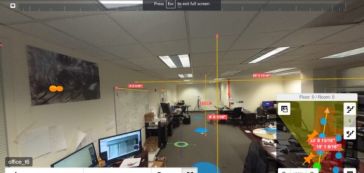
Indoor mapping is a novel concept that uses a digital 2D or 3D map to represent an indoor venue and spatial information. Indoor positioning and navigation are made possible by presenting places, people, and assets on a digital map. As a result, many various use cases are possible, allowing businesses to improve their workflows and efficiency.

In early May 2018, the Czech company UpVision used an unmanned aerial vehicle (UAV) to map a copper mine in Mongolia – the largest in Asia – as part of an ongoing Czech geological expedition at th...

GEO Business 2018, taking place in London from 22-23 May, is fast approaching and the 5th instalment of the largest geospatial show in the UK is getting ready to break some records. Firstly, with regi...

Esri, a global leader in spatial analytics, has announced ArcGIS Online users can work on their own private content directly within Microsoft Power BI using the built-in visualisation software ArcGIS ...

3D Target and Velodyne are expanding their relationship with the integration of Velodyne’s Puck LITE VLP-16, Puck Hi-Res VLP-16 and ULTRA Puck VLP-32C Lidar sensors into the growing Scanfly product ...

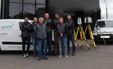
Murphy Surveys has announced that due to unprecedented growth, it will continue to expand its footprint in the UK with a new office and team based in the new Blackbox development in Wilmslow, near Man...

苹果已经获得批准to conduct flight tests in the USA aimed at using images captured by unmanned aerial vehicles (UAVs or ‘drones’) to improve the quality of its Apple Maps app. The confi...

Indoor Reality has announced its most affordable hardware yet, the IR-200, a phone-based scanning system that can be used as a standalone Android or iOS app on mobile phones, or in conjunction with an...

Trimble has announced that it has added Crop Health Imagery and Work Orders features to its Trimble Ag Software. The software is a desktop, cloud-based and mobile-enabled agricultural solution that si...

Esri, the global leader in spatial analytics, has announced the launch of the Africa GeoPortal, a comprehensive cloud-based platform that provides rich content and solutions from Esri and its partners...

Airbus Aerial, the commercial aerial services, has recently conducted runway mapping and inspections at the world’s busiest airport – Atlanta’s Hartsfield-Jackson International (ATL). Officials ...
This site uses cookies. By continuing to use this website, you agree to ourCookies Policy.Agree