Is GIS Moving to the Cloud and Becoming IT?
The ARC Advisory Group has conducted research on the GIS market to conclude that GIS technology, which was once considered highly specialised, is now moving into the realm of mainstream Information T...
Indoor mapping is a novel concept that uses a digital 2D or 3D map to represent an indoor venue and spatial information. Indoor positioning and navigation are made possible by presenting places, people, and assets on a digital map. As a result, many various use cases are possible, allowing businesses to improve their workflows and efficiency.

The ARC Advisory Group has conducted research on the GIS market to conclude that GIS technology, which was once considered highly specialised, is now moving into the realm of mainstream Information T...

Sphere Drones, a leading Australian provider of drone solutions for commercial applications, will become a distributor of Microdrones fully-integrated systems. Currently, the most popular systems in t...

The first partnership communication meeting of United Nations World Geospatial Information Congress (UNWGIC) was held in Deqing, China on 24 July 2018. Representatives from more than 40 enterprises at...

NASA has launched a drive for commercial applications of its data and analysis tools with the launch of its remote sensing toolkit. Since 2013, NASA has developed and maintained an agency-wide plan, p...

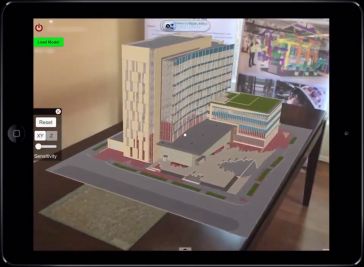
VisualLive has released MobiLive, an app that allows you to place true scale BIM models on site coordinates, and manipulate them to visualise how it looks in the real world, or during different constr...

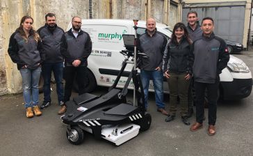
Murphy Surveys has introduced the IDS GeoRadar Stream C as their latest addition. The Stream C solution will augment their existing service offering and will provide clients with faster, more accurate...

Sentinel-5P数据对公众开放,Copernicus Atmosphere Monitoring Service (CAMS) has begun processing with detailed forecasts anticipated later in 2018. The Sentinels are a fleet of satellites...

Esri, the global leader in location intelligence, has announced that Survey123 for ArcGIS, Esri's smart-form-data gathering solution, will now be offered as part of Microsoft Flow's connector communit...

The PASCO Corporation, a company that processes and analyses geospatial information for solving social problems (especially using Earth Observation satellites), has won the DeepGlobe Satellite Challen...

The Department for Digital, Culture, Media and Sport (DCMS) has published its ‘Framework for UK Fibre Delivery’ as an important step in supporting the upgrade of the UK’s digital infrastructure ...
This site uses cookies. By continuing to use this website, you agree to ourCookies Policy.Agree