Trimble扩展了用于地理空间监控的传感器集成
Trimble has introduced the latest version of its core geospatial automated monitoring software: Trimble 4D Control version 6.3. The software provides automated movement detection to enable informed decisions about infrastructure for surveying, construction and monitoring professionals.
版本6.3为软件添加了新功能,与Trimble SX系列扫描总站的高级成像和测量功能相结合使用。此版本还支持行业领先的振动和气象站传感器以及该字段中的TRID访问监视模块之间的简化工作流,该文件在办公室中使用的新T4D访问版。
Enhancements made to Trimble’s core geospatial monitoring software provide increased accuracy, simplified sensor data collection, reporting and alarms, and make it possible to seamlessly move from semi-automated to fully automated monitoring on a project.
More accurate measurements and sensor integration
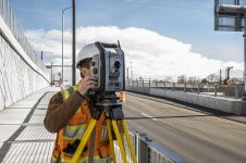
Integrating with the Trimble SX Series scanning total station, T4D users benefit from Trimble VISION imaging technology and high-accuracy Lightning 3DM technology for more accurate measurements, enabling a more dense target placement on linear corridors such as rail tracks, tunnels, roads and bridges. A live video feed makes it possible to better understand site conditions, manage target placement remotely and capture images for use with T4D visual inspection capabilities. These images can be compared over time and viewed next to the displacement or movement charts. This enables users to identify the potential cause of displacement and record movement changes over time.
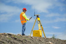
Users can now integrate industry-leading solutions from Syscom and Vaisala withT4D版6.3.. Vibration sensors from Syscom allow surveying, civil and geotechnical engineers to easily combine geodetic and geotechnical information supporting high frequency and event-based vibration information. This data is often used for mandatory reporting on civil and infrastructure projects. Integration with the Vaisala weather station enables users to analyse the impact of environmental conditions such as temperature, rainfall, wind and atmospheric pressure in combination with other geospatial and geotechnical monitoring information, which is useful for slope stability analysis in mining, landslide and dam monitoring operations.

从半自动转换到全自动监控
With the introduction of the new T4D Access Edition, customers can now benefit from the automated, seamless transfer of field data from the Trimble Access Monitoring Module to the T4D Access software in the office. This enables users to scale monitoring operations from a semi-automated to fully automated monitoring system while maintaining the continuity of historical data in the same charts and reports.
“通过将T4D与TRIMBES SX系列扫描总站集成和TRIMBER Access Monitoring模块,我们为客户提供了用于监控应用程序的更广泛的Trimble解决方案,”Timble Geo空间的商业领域主任Boris Skopljak表示。“我们还在继续扩大对额外传感器等额外传感器,如Syscom的振动传感器和Vaisala的气象站。这使我们的客户能够利用甚至更全面的交钥匙解决方案。“
让你的收件箱更有趣。Add some geo.
Keep abreast of news, developments and technological advancement in the geomatics industry.
免费注册


