Pointfuse and U.S. CAD Announce Partnership
Pointfuse has signed a reseller agreement with one of the largest Autodesk and Leica Geosystems distributors in the USA. California-based U.S. CAD is an AEC technology consultant with 20 years’ experience in combining BIM content creation and 3D modelling with application development and configuration services. The addition of Pointfuse advanced point cloud processing software to U.S. CAD’s product portfolio will release the power of laser scanning and photogrammetry for a range of digital construction, facilities management and virtual design workflows.
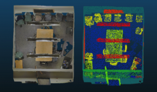
Pointfusesoftware converts the millions of individual measurements captured by laser scanning and photogrammetry into useable 3D mesh models. The unique ability to classify objects within Pointfuse, both automatically and manually, has already had a huge impact on how as-built data is used within design and construction workflows.
“We are delighted to be the first Autodesk Partner and Pointfuse reseller in the US,” commented Jeff Rachel, president ofU.S. CAD. “The addition of Pointfuse’s processing power and interoperability to our offering will truly help our customers integrate laser scanning, photogrammetry and mobile mapping systems within their organizations.”
IFC parametrized objects
“美国CAD是一个国家最and respected AEC industry technology and consulting firms and is an Autodesk Authorized Platinum Partner,” commented Mark Senior, regional sales director at Pointfuse. “Their presence in key major metropolitan markets makes them ideally placed to support clients as they implement Pointfuse into working practices helping to realize the potential benefits of point cloud data.”
新最近rel Pointfuse特性eased include Pointfuse ‘simple BIM’ (sBIM) which leverages the core functionality of Pointfuse - the segmented mesh model - automatically converting classified mesh models into ‘family’ groups, such as walls, floors, doors, windows, etc. for use with popular downstream BIM and FM software. Pointfuse sBIM data can then be exported as IFC (Industry Foundation Class) parametrized objects and 2D floors plans and space management reports easily derived. Pointfuse sBIM also automatically calculates quantities, areas and dimensions in an easy to read PDF report.
Make your inbox more interesting.Add some geo.
Keep abreast of news, developments and technological advancement in the geomatics industry.
Sign up for free


