ISPRS UN-GGIM National Mapping and Cadastre Agency Forum
UN-GGIM National Mapping and Cadastral Agencies Forum
National mapping and cadastre agencies provide geospatial data of various levels of detail, types, and scales, which form the basis of today's geospatial data infrastructure – an indispensable national asset for sustainable development of the country and many other applications.
The Forum sessions (14-15 July) will be comprised of invited and presented papers. One session will be a shared session of the National Mapping and Cadastre Agencies and Space Agencies. It will be dedicated to two important questions:
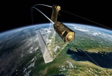
- How do National Mapping and Cadastre Agencies use satellite remote sensing data?; What they would like to see improved, etc.
- What are the plans of Space Agencies and Earth Observation Companies in the sphere of data for National Mapping and Cadastre Agencies?; How to strengthen this cooperation?
You will have the opportunity, among others, to talk to geospatial semantics and data modelling specialists from USGC, or meet the renowned photogrammetrist Gottfried Konecny or chair of the Czech national land survey office Karel Brázdil.
IAA Space Agency Forum
IAA航天局论坛的会议comprised of invited and presented papers. One Forum session will be a joint session between the National Mapping and Cadastral Agencies and the Space Agencies. It will focus on two questions:
- How do National Mapping and Cadastral Agencies currently use, or could potentially use, Earth Observation data, and what would they like to see improved?
- What are the plans of Space Agencies in the sphere of providing support to Mapping Agencies, and how can this cooperation be strengthened?
Present, among others, will be Jan Kolar, vice president of the International Astronautical Federation, and Volker Liebig, director of ESA EO programmes and head of ESA- ESRIN, and Pascale Ehrenfreund, chair of the DLR executive board.
Make your inbox more interesting.Add some geo.
Keep abreast of news, developments and technological advancement in the geomatics industry.
Sign up for free


