GIS观察系统为生命提供水
作为主要供水和电力发电机in great Taipei, the Feitsui Reservoir is a vital resource in Taiwan. Feitsui Reservoir Administration therefore needs to ensure that water quality, water supply and the land use of catchment area are under control. To manage this 303-square-metre reservoir in a timely manner, the authority decided to establish a GIS application, enabling the officers to observe and manage the whole area on the map.
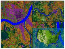
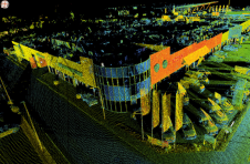
通过使用SuperGIS Server作为核心软件,Feitsui水库集水区的土地利用调查系统能够将各种资源集成在一个GIS平台中。经理可以轻松收集相关信息,如水位和质量,降水,卫星图像,中央电视台,坐标信息,潜在的滑坡区域和迹象地点,以制定适当的决策。
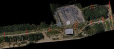
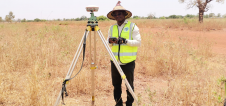
Land Use and Transformation of Catchment Area Management and Query System was also built based on SuperGIS Server to provide administrators a platform in querying and updating latest land use status. With UAV and GPS technologies, administrators can greatly save time on surveying, and manage all the needed data with GIS online.
该系统不仅用作日常供水信息源,而且还提供了管理局来监控和防止集水区非法发展的工具。此外,对于SuperGIS动力系统,该权限能够在为更多生命中提供更好的水资源来平稳地集成和交换其内部数据。