Geospatial Solutions to the Challenges of Mining
We’ve selected a number of articles providing an overview of the geospatial solutions used to solve challenges in the mining sector, ranging from infrastructure design to mapping & surveying the environment around mines and potential mining areas. These articles also discuss various applications of data collection techniques such as Lidar and photogrammetry.
Surveying in the Mining Sector
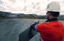
Geospatial data forms the foundation of mining. The rapidly evolving innovations in the geomatics sector are bringing previously unforeseen opportunities that will provide a major boost, both to mining surveyors and the mining industry as a whole. Read on for an article which starts with some history – after all, we should never forget where we came from. It then goes on to present a general outline of surveying in the mining industry, with a focus on the survey equipment and the technologies that are being used today.
Low-cost UAS Photogrammetry for Mining
Unmanned aerial survey (UAS) photogrammetry has proven to be a good alternative for capturing open-pit mines, but it is expensive when done professionally. This article investigates whether low-cost UAS photogrammetry, using consumer-grade copters, is sufficiently accurate for 2D and 3D mapping of quarries based on a project in Ukraine.

Automated Mobile System for Mapping Mine Shafts
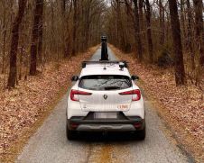
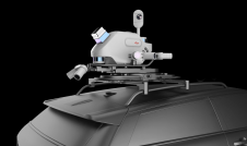
Mine shafts are governed by special rules, often difficult to access and known for their unfavourable conditions for measurements. A mine shaft is of strategic importance for the proper functioning of the mine in terms of air ventilation, transport of people and material extraction, for example. Therefore, not least for safety reasons, mine shafts require regular inspections and surveys. For this purpose, the company SKALA 3D has developed an automated mobile laser scanning system as a mining survey system (MSS) which facilitates fast and precise measurements. The result is a comprehensive 3D model of the mine shaft ready for further analysis.
3D UAS Mapping of a Copper Mine
In May 2018, the Erdenet Mine in the north of Mongolia was mapped in just three days. The open pit mine measures 5km by 2km and has an elevation difference of 200 metres. The dusty and complex circumstances called for the use of an unmanned aerial system (UAS). Despite the strong wind and extremely variable weather conditions, a single UAS quickly captured the geospatial output necessary for the management of one of Asia’s – and the world’s – largest copper mines, as described in this article.
There’s No I in Survey
Terrestrial laser scanners were introduced to the mining industry as a smart tool for surveyors – a high-technology method for obtaining data more quickly and safely than previous methods. In fact Peter Johnson, the author of this column, started his career at Maptek overseeing the development of the first purpose-built-for-mining laser scanners. The potential for laser technology to transform entire mine sites was obvious 20 years ago, and the level of detail and accuracy that these compact instruments can achieve is astounding, he writes.

Make your inbox more interesting.Add some geo.
Keep abreast of news, developments and technological advancement in the geomatics industry.
Sign up for free

