Dutch Mapping Company Creates Digital Twin of Historical Gateway
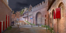
4Indoor has used a wearable NavVis VLX mobile mapping system to create a high-quality 1.2GB point cloud of the medieval gateway called Koppelpoort in the Dutch city of Amersfoort. 4Indoor, a 3D measuring specialist based in Amersfoort, wanted to digitally capture historical unique and beautiful places in the city.
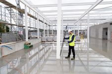
The company conducted this ambitious reality-capture project in the historical centre of Amersfoort using a NavVis VLX mobile mapping system.
Together with over 850 panoramic HD images, it was possible to completely digitize the premises, creating an accurate digital twin of all the historical buildings that make up the gateway. This includes as-built floor plans and sections created with the help of the high-quality point cloud comprising billions of points.NavVis IVIONgives the building owners remote access to the digital assets – completely independent of their location – using any standard web browser on a laptop, tablet or smartphone.

The Koppelpoort Gateway
The Koppelpoort is part of the second ramparts of the city. It was constructed between 1380 and 1450, around which time the entire wall was completed. As a unique combination of a land gateway and a water gateway, it is one of a kind in the Netherlands. Travellers could be admitted or stopped via this combined gate. In addition, the gateway could be used to regulate the flow of water from the River Eem into the city centre.

The 4Indoor team are proud of being based in the beautiful city of Amersfoort and they wanted to map a historical location in their own city - not only in the shape of a point cloud, but also with high-resolution panoramic images. By creating this digital twin, the company has captured a piece of Amersfoort’s history for future generations.
About 4Indoor
4Indoor是一个创新的行业性Amersfoort-based公司zed in 3D measuring and visualizing real estate. It claims to be the founder of (indoor) mobile mapping in the Netherlands: scanning at lightning speed and capturing 360-degree images without compromising on quality. With great passion and pleasure, the company helps its customers with their digitization strategies. The digital twin solutions enable users to make better operational decisions, increase productivity, streamline business processes and improve profitability.

Make your inbox more interesting.Add some geo.
Keep abreast of news, developments and technological advancement in the geomatics industry.
Sign up for free


