Bluesky Help ArcHeritage Reveal Hidden Treasures for the National Trust
本文最初发表在地理学世界。
3D从飞机安装的激光器创建的地图在英国北安普敦郡历史悠久的Canons Ashby庄园里帮助国家信任露出秘密。
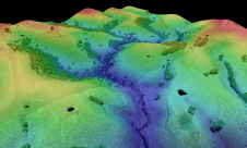
与专业考古和遗产实践研究院,国家信托委托空中映射公司Bluesky完成了一个690公顷,周围和包括遗产的Lidar调查。从收集的数百万个单独的激光测量中,BlueSky创建了裸地面表面(数字地形模型/ DTM)的高分辨率3D模型以及其表面特征,包括建筑物和树木(数字表面型号/ DSM)。
对模型的分析已经发现了300多个潜在的考古特征在调查区内,而与航空照片相比,追溯到20世纪40年代,有助于确定更多最近的特征和活动。
“The use of the Bluesky LiDAR data within such an important piece of historic landscape research gives a much better understanding of the site and its immediate environs, and is one of numerous studies that will help to inform conservation and interpretation at Canons Ashby,” commented Anna Badcock, Director of ArcHeritage. “High quality LiDAR data has already led to some amazing discoveries at other National Trust landscapes, and we are confident that the data will add to and enrich the story of the Canons Ashby landscape.”
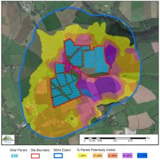
Accheritage还使用数据来创建理论可见区域(ZTV);计算机生成的工具有助于识别Canons Ashby的设置。ZTV将有助于国家信任了解Canons Ashby House的潜在观点,为基于未来景观变化的视觉影响提供了一个有用的工具,以制定决策。


