Airborne Lidar Survey in the Eastern Caribbean in Full Swing
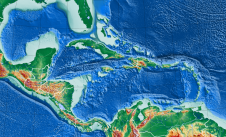
The Caribbean Community Climate Change Centre has commenced Lidar surveys in ten Borrowing Member Countries (BMCs) of the Caribbean Development Bank (CDB): Antigua and Barbuda, Barbados, Belize, Guyana, Suriname, Saint Lucia, St. Kitts and Nevis, St. Vincent and the Grenadines, Trinidad and Tobago and Turks and Caicos.
These Lidar surveys are the culmination of years of foresight, effort and dedication to provide affordable geospatial, high-resolution topographic and bathymetric data that allow decision-makers to plan their climate resilient development programmes and projects using an evidence-based approach. This phase of the Lidar programme commenced in Barbados on 31 March 2022.
Establishing a Geospatial Dataset for Enabling Sustainable Development
The acquisition of what appears to be the first Caribbean-centric state-of-the-art Lidar system, capable of acquiring both bathymetric and topographic surveys, was made possible through financing from the United States Agency for International Development (USAID) under the recently concluded Climate Change Adaptation Program (CCAP). The CDB provided critical financial support to theCCCCCto undertake pilot bathymetric and topographic Lidar surveys in its BMCs in an effort to demonstrate the utility of Lidar data in climate resilient development while the Government of Italy, through the Ministry of Ecological Transition (MiTE), formerly the Italian Ministry for the Environment, Land and Sea (IMELS), provided grant support to the CCCCC to undertake necessary baselining to inform Lidar survey planning.
The Caribbean Lidar programme aims to establish a critical high-quality geospatial dataset for enabling sustainable development resilient to climate change and sea-level rise, support the conduct of demonstration type bathymetric and topographic surveys in BMCs, train BMCs data end-users, and strengthen the capacity within the Centre to provide data management services.
Lidar Surveys for the Benefit of the Caribbean Region
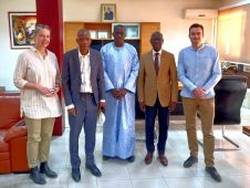
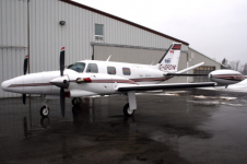
Airborne data acquisition has been made possible through a public-private partnership via an agreement with Maya Island Airlines out of Belize initially, and subsequently, through a Framework Agreement with Leading Edge Geomatics (LEG) out of Canada. “Despite many delays and challenges caused by the COVID-19 pandemic, the CCCCC is proud and excited to be able to commence this historic Caribbean Lidar program across the Region that will contribute high-quality geospatial data to Member States to inform their climate resilient development plans and disaster risk reduction strategies,” says Dr Colin Young, Executive Director of the CCCCC. “The fact that the CCCCC now possesses Lidar capacity is a testament to the vision of Dr Kenrick Leslie, former Executive Director of CCCCC, the Centre’s resolve and the strategic partnerships with donors such as the USAID, Government of Italy, the CDB, and the participation of the private sector. With this capacity, resident in the Region, we look forward to working with CARICOM Member States and the private sector to deliver high-quality Lidar surveys and products at reasonable and affordable costs for the benefit of the region and our Caribbean people,” concluded Dr Young.
这个项目直接有助于核心曼ate of the Centre – that of collecting and using climate data and information to inform evidence-based decision-making across the Region. The Board, management, and staff of the CCCCC are “most grateful for the support of our donors, the commitment of our partners, and the resolve of our team in making this programme a reality.”
Make your inbox more interesting.Add some geo.
Keep abreast of news, developments and technological advancement in the geomatics industry.
Sign up for free


