The Three Pillars Supporting a Regional SDI for the Americas
To borrow the words of a beautiful Beatles’ song, it has been a “long and winding road” that has led to an SDI in the Americas. This complex journey has already taken over a decade of efforts which have been advanced, but not necessarily coordinated, by various stakeholders, from government and academia to industry and users. For years, the PAIGH has supported member states in their endeavours towards establishing national and regional SDIs since national geographic institutes in the Americas are the main producers and certifiers of the spatial data developed in each country. The SDI in the Americas is evolving at its own pace and, regardless of contributions at the supranational level, is based on the results attained by three essential pillars:
• SIRGAS – The Geocentric Reference System for the Americas. Established in 1993 in Asuncion, Paraguay, it is the regional densification of the International Terrestrial Reference Frame (ITRF). SIRGAS provides the regional SDI with the geometrical reference system that is essential for its development. SIRGAS is currently incorporating Central America and is recommended by the UN as the official reference system for all American countries.
http://www.sirgas.org
• PC-IDEA – The Permanent Committee for Geospatial Data Infrastructure of the Americas. Established in 2000 in Bogota, Colombia, at the recommendation of the United Nations Cartographic Conference for the Americas, it focuses on social, economic and environmental goals derived from the use of geospatial information. PC- IDEA currently has a very active Working Group on Planning which is key to advancing national policy formulation, for instance, concerning open data and the implementation of growing institutional arrangements. More importantly, PC-IDEA represents the region in the context of the newly introduced United Nations Global Geospatial Information Management (UN-GGIM) initiative.
http://www.cp-idea.org
• GeoSUR – The Geospatial Network for Latin America. Established in 2007 in Brasilia, Brazil, by the Latin American Development Bank (CAF) and the PAIGH, it is a regional initiative to integrate and disseminate spatial data in Latin America and the Caribbean. GeoSUR services provide access to regional datasets and national data available in map services and data catalogues provided by more than 60 partner agencies. A key driver for GeoSUR has been the implementation of innovative applications responding to the needs of its partners and stakeholders. http://www.geosur.info
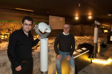
SIRGAS, PC-IDEA and GeoSUR are therefore the three pillars supporting the construction of an SDI in the Americas. All three are in the hands of recognised regional leaders: Claudio Brunini (Argentina), Luiz Paulo Fortes (Brazil), and Eric van Praag (Venezuela). The PAIGH has been a natural partner for its creation and is interested in contributing to its development for the benefit of the SDI community in the Americas. In this way, we are helping to achieve one of our priorities: to spatially enable our diverse communities.
Make your inbox more interesting.Add some geo.
Keep abreast of news, developments and technological advancement in the geomatics industry.
Sign up for free


