LIDAR的未来对我们世界的未来至关重要
LIDAR的未来是什么?引用亚伯拉罕·林肯(Abraham Lincoln)的话:“预测未来的最可靠方法是创造它”。那么,当前在地理空间市场中正在创建什么?本文侧重于与许多相关主题有关的LIDAR:LIDAR技术,开放数据和人工智能/机器学习(AI/ML)。
LIDARtechnology is developing rapidly, as illustrated by the number of start-up companies to serve the autonomous market which feature traditional mechanical scanning devices, tiny-chip solid-state Lidar units and the emerging FMCW Lidar. The fact that Apple has announced an iPad with Lidar indicates this technology’s arrival in the public domain; whereas it was a challenge to even explain our industry a few decades ago, now many consumers are familiar with the term ‘Lidar’! Moreover, the availability of the technology on a consumer device could be an enabling medium for building information modelling (BIM) and digital twin efforts in the construction world. But discussions surrounding the future of Lidar have many tangents, and technology is just one of them.
激光雷达技术
在过去的几十年中,光子学和激光雷达的生长和发展是戏剧性的。我们在获取数据的能力方面经历了巨大的进步。系统的规模,性能和生产力已成为测量和映射专业的变革性。执行工作的方式以及最终用户的期望正在不断变化。该技术的巨大改进导致了更高的脉搏重复率(PRR)和小型化。这将持续到我们达到摩尔法律的范围。LIDAR一词是指各种组件的系统。这种复杂的系统具有优势和局限性,物理定律也是如此。当我们在这些系统的一个领域达到限制时,我们发现相关领域的进步。一个例子是5G在改善城市中心的姿势估计方面将发挥作用。
Another example occurs with resolving range ambiguities, which becomes increasingly difficult for single-channel instruments. This impacts system design to accommodate multiple-channel instruments. For instance, each channel is operating at a PRR of today’s standard, but with individual looking directions. As a result, we will see more specialized laser scanners for specific tasks, like corridor mapping and power line monitoring, featuring unique scan patterns for minimizing shadowing effects.
在电子中,微型化的作用是显而易见的无人驾驶飞机(UAVs or ‘drones’). The marketplace is seeing optimized sensors for corridor mapping borne by vertical takeoff and landing (VTOL) platforms. These new systems are lightweight and their orientation results in reduced object shading. They feature high measurement accuracy and high measurement speed, with distinct multi-target capability.

Open Data
The impact, value and importance of open geospatial data are now regularly seen. The geospatial market has matured in the past decades to the point that it has become critical to how we view ourselves and manage our world. The dashboards monitoring the spread of the COVID-19 pandemic around the globe are an excellent example. Free data from satellite systems showed impacts of the virus spread, regardless of the veracity of the reporting country’s statistics, such as by demonstrating the greening of the planet during the economic shutdown.
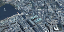
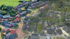
In the Lidar field, we have examples of country mapping where the result is open to all potential users free of charge and without a licence. This has spawned use in remarkable areas. Many cities, counties and states have used this data to improve the management of their districts. Country mapping efforts are seen all over the globe but the EuroGeographics council is a stellar example of this accelerating trend: countries such as the Republic of Ireland and the Netherlands have established country mapping efforts, and瑞士在其地形图中已有3D。
TheNOAA Shoreline Data Explorerto track and monitor storms and sea rise is another example of open data at the service of the population. This example of bathymetric Lidar data is extraordinarily critical for saving lives and property. The impact of smaller UAV-borne bathymetric systems will highlight the ability of local districts to monitor critical wetlands and calculate water loads in rivers and streams to protect us from recurring flooding.
In the USA, the USGS’s example of open data is the3DEP programme。它用于许多传统领域,例如运输和水管理。但是,所有人免费的大量地理空间数据是免费的,许多人在硅谷下载了它,以使他们能够检查其地图并纠正其产品。这是一个很大的地理空间数据实用程序,用于协助消费者和公司使用正确的数据。188asia备用网址

Artificial Intelligence/Machine Learning
机器学习中的低级任务(例如,点云的高速分类)是一些低悬垂的水果,可促进生产率提高。下一个级别将带来数据挖掘的承诺,以进行更准确的预测,评估变化的影响以及资源的有效利用和分配。
Over the decades, there has been increasing demand for highly accurate, high-definition and increased-density point cloud data with equidistant point patterns. This is what people call ‘high fidelity’. This provides the world with the visualization necessary to manage the ecological impact of populating the planet. Thus, we see the importance of geospatial analytics to the management of our world. It has been estimated that we utilize only perhaps 20% of a typical point cloud. Through the growth of AI/ML, we will eventually be able to utilize all the information that the digital signal processing regime of Lidar provides.
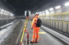
LIDAR的承诺在于信息的准确性和完整性以及相关附加传感器数据的集成,以提供所需的高保真可视化。一个示例是走廊映射。走廊是我们世界的关键要素。如果没有及时捕获,较小的岩土危害可能会造成破坏。能够清楚,正确正确地“查看”物理资产的需求至关重要。具有适当传感器集成的高保真激光雷达系统将成为提供AI/ML常规发现问题和入侵并避免灾难所需的可视化的标准。
AI/ML, open data and the Lidar technology itself are just some of the critical factors involved in the future of Lidar for the geospatial industry. We may not be able to predict the future but, in view of all the work being done in the industry, we can see that we are on the right path.

Make your inbox more interesting.Add some geo.
Keep abreast of news, developments and technological advancement in the geomatics industry.
Sign up for free

