Simultaneous Capturing of Lidar and Imagery
主要城市如何从混合传感器系统中受益
在英国和爱尔兰进行的空中调查表明,Nadir摄像头,斜相机和LIDAR单元的结合可能性,以满足准确,详细和最新的3D城市模型的需求。
People continue to migrate from rural areas to major cities, driving sustained urban growth and increasing the demand for accurate, detailed and up-to-date 3D city models. The creation of such models is still a cumbersome endeavour but new advancements, such as the combination of three sensor types – nadir camera, oblique cameras and a Lidar unit – in one and the same geodata acquisition system, may bring relief. Aerial surveys conducted in major cities in the UK and Ireland demonstrate the potential of this solution.
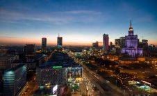
Cities will continue to grow as long as the world’s population keeps flocking to urban areas. In western countries, migration from rural to urban areas started in the early 1800s, and by the early 1900s 15% of the global population was living in cities. This will have increased to 60% by 2030, thanks in part to the large-scale shift towards urban living in Africa and Asia which began in the mid-1990s. This population concentration has created dozens of urban agglomerations with over 10 million inhabitants, called megacities. According to a study of the world’s demography by Euromonitor International, in the decade between 2020 and 2030 six new megacities will emerge: Chicago, Bogota, Luanda, Chennai, Baghdad and Dar es Salaam. By 2030 there will be 39 megacities, which between them will be home to nearly 10% of the population and produce 15% of the world’s gross domestic product (GDP). The liveability and sustainability of megacities rely on well-functioning roads, subways, railways, bridges, schools, hospitals and other public services.
3D城市模型
Most modern cities and megacities have become complex, multifaceted 3D landscapes. Those responsible for the management, security and development of these major cities require detailed 3D models of buildings and infrastructure to support them in their tasks. 3D models are usually produced manually from stereo photogrammetry. Accurate and detailed 3D city models are in high demand, but expensive to produce. Realistic views require rendering with images, which is a labour-intensive activity. Often 3D city models consist of rendered polygon meshes that are common in computer graphics, gaming and animation. For 3D city modelling, mesh models are used for visualization, line-of-sight analysis, risk assessment, noise modelling, flood modelling, master planning and much more. They are also indispensable for creating smart cities.

网格型号
网格是一群边缘,线条和面孔,define the surface shape of a 3D object. The faces often consist of a network of triangles usually referred to as a triangular irregular network (TIN). The higher the point density is, the denser the mesh and the more detailed the representation of the 3D object will be. If the points constituting the triangles are represented in the same reference system as images, photorealistic 3D objects can be combined to create an entire city highly automatically. Airborne Lidar and vertical and oblique aerial images are well suited to the creation of 3D city models. Mesh models are often regarded as purely visual 3D models. However, limiting their use to visualization purposes alone would do an injustice to their full potential. Particularly when georeferenced at decimetre accuracy or even higher, such 3D data can be used for measuring distances, heights, surfaces and volumes. In addition it allows line of sight and other types of analysis, shading and flood modelling. Once it is known that a collection of adjacent meshes form a building or other coherent object, it is possible to assign an address, market value, BIM information or other information to the conglomerate of meshes. Attributing semantic information allows queries and intelligent analysis to be conducted.
瓶颈
在创建3D网格城市模型中,有几个瓶颈。其中一种瓶颈涉及整个调查区域中同质数据的获取。图像产生的点云显示出障碍,即使图像是用高重叠获得并使用密集的图像匹配技术获取的,从而导致某些区域的NO(或不可靠)点提取。这些缺点的原因包括:
- 阻塞:在狭窄的街道或城市峡谷中,某些物体可能会阻止其他物体(例如建筑物)的视图。要从图像中提取3D点,这是至少两个图像中可见对象的基本要求。
- 阴影的存在:尽管基于半全球匹配的密集图像匹配在没有边缘和纹理的情况下非常健壮,但仍可能导致不可靠的匹配。
Today’sairborne Lidar systems能够创建具有高点密度的点云。但是,这些点只有一个光谱值,即返回脉冲的强度。然而,回报不受阳光引起的阴影的影响,与摄影测量相比,这是一个明显的优势。由于只需从一个角度看待物体,因此空气传播的激光雷达受遮挡的影响小于摄影测量法。

CityMapper
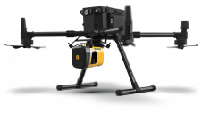
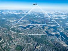
To tackle the above-mentioned bottlenecks of photogrammetry on the one hand and airborne Lidar on the other, Leica Geosystems has combined three sensor types in the world’s first hybrid airborne geodata acquisition system. CalledCityMapper,该系统结合在一起 - 在一个吊舱中 - 一个用于捕获Nadir图像的RCD30 CH82多光谱摄像头,四个RCD30 CH81M摄像机用于捕获斜图像和一个LIDAR单元(图1)。根据马耳他交叉概念,纳迪尔和倾斜的头部排列(图2)。Nadir摄像机的图像以0.78至0.88µm的速度捕获RGB和近红外(NIR)。四个斜摄像机以45度向前,向后,左右捕获RGB图像。Nadir图像可以在三厘米的地面样品距离(GSD)中捕获,其潜在精度为6厘米,均方根误差(RMSE)。在图像的中心,由于角度和焦距的组合,倾斜图像的GSD约为Nadir GSD的75%。当Nadir图像的GSD为5cm时,中心的斜图像的GSD为3.7厘米。LIDAR单元发射的激光脉冲,波长为1,064µm,脉冲重复频率高达700kHz。精度为6厘米,点密度为每平方米15点,在750m的飞行高度下。这三种传感器类型或其规格都不是新的。 The workflows of generating outputs from the three data types are well established and operational in many photogrammetric companies. What is new is that incorporation in a single pod and using a single control unit enables the imagery and Lidar point clouds to be acquired simultaneously. This simultaneous data acquisition offers many advantages for the creation of 3D city models. For example, Lidar pulses are able to penetrate street canyons where there may be shadows due to obscured sunlight, and in narrow streets – where occlusion might prevent cameras from obtaining two views – Lidar can double the chance of successful data capture.

用例
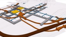
CityMapper已在亚洲广泛部署,以精确而详细的3D映射,其新的大型速度具有巨大的摩天大楼,自2000年以来一直以令人叹为观止的速度建造,现在在欧洲也在增长。在2018年和2019年,总部位于英国的空中地图公司布鲁斯基(Bluesky)占领了伦敦,曼彻斯特,伯明翰,剑桥,牛津和其他几个英国城市的部分地区。图3显示了塔桥的斜图像,图4显示了伦敦圣保罗大教堂周围地区和爱尔兰都柏林的3D网格模型(图5)。使用Nadir和倾斜图像以及LiDAR Point Clouds使用hxmap,其中包含用于数据下载和原始质量控制的工具。提供空气三角剖分,辐射测量和点云的注册和地理发酵的其他工具。随后,将数据进一步处理到数字表面模型,数字地形模型,矫形图和其他源自CityMapper图像和LIDAR点云的产品,这些云称为“ Metrovista”。作为主要运输基础设施项目的一部分,是一个逼真的MetroVista3D网格模型用于通过将对象添加到精确的3D网格模型处,以洞悉拟议构造的影响。现有现实世界的模型与拟议的发展相结合,可以将发展的性质和规模传达给利益相关者和公众。

挑战
Needless to say, the creation of sophisticated, high-accuracy products which benefit city governments, managers and planners alike is not without its challenges. An aerial photogrammetric survey produces large data volumes that require parallel processing and hence significant investment in hardware and software in order to process, disseminate and share them efficiently and reliably. Other challenges include the weather in the UK, which is often not ideal for conducting aerial surveys. The flying height – between 1,000m and 1,800m – is lower than standard aerial surveys, which can be beneficial since it is often below cloud cover. However, the lower flying height can also draw increased attention from air traffic control in the crowded airspace above cities and megacities, leading to delays. Moreover, the flying speed – which at around 220km/h is slightly slower than for traditional survey flights – increases the data capture time, which may cause issues with permissions or weather windows.
致谢
This feature article is partly based on the results of aerial surveys conducted by Bluesky in the UK, using Leica’s CityMapper. Particular thanks are due to Penny Boviatsou (Hexagon) and Laura Eddy (蓝天)。


