Report: First European Aerial Surveying Summit
Generating Sustainable Business for an Innovative Industry
当今的数字社会需要不断提供更新,可靠和正确的地理位置,而新技术的速度正在越来越高。这manned aerial survey isby far the main source of high-resolution geographical data in the geoinformation ecosystem. This article looks back on the first edition of the European Aerial Surveying Summit, which was held in Denmark in December 2018.
When people talk about geographical data and its creation, then satellites orunmanned aerial vehicles (UAVs or ‘drones’)– ubiquitous in the daily media stream – often spring to mind. Lately, mobile surveying systems have started to take on a growing role in data capture, especially in urban areas. While all these sources are playing an important part in the geoinformation ecosystem, the main source of high-resolution geographical information remains, overwhelmingly, the manned aerial survey.
Many critical governmental planning processes at any level of authority, whether for fair distribution of subsidies, transport infrastructure planning or flood protection, require a coherent geographical dataset in the accuracy and resolution band of better than 25cm (and for engineering processes down to under 3 cm).
Many processes are already migrating to three-dimensional data. A specific example is the area of flood prediction and protection measures, where an increase in geometrical accuracy can help to prevent catastrophic events. Additionally, flood events are subject to regional influences, and updated high-resolution height models are scarce and inconsistent across national and state borders. Other areas that are increasingly dependent on high-resolution height information include 5G network planning and power transmission, both of which are crucial elements of digital societies.
Today, over 90% of such data originates from manned aerial survey. The reasons are simple: satellites do not provide the required geometrical resolution and accuracy, drone applications are not yet suited for wide-area surveys, and mobile mapping systems are restricted to movement along roads or rails and provide only the horizontal perspective.

Aerial imagery market size
就市场规模而言,大多数消息来源都同意,全球航空影像市场目前的价值在15亿至23亿美元之间,复合年增长率(CAGR)在11.5%至14%之间。这全球机载激龙market is estimated to generate US$1.3 billion to US$1.8 billion at a CAGR of 16-22%. With North America being responsible for 35-45% of the global share, Asia 20-30%, and Europe 15-25%, the value generation is considerable.
At the same time, and despite this impressive market size, the European aerial survey industry is facing challenges: a new wave of market protectionism and isolationism, prices spiralling downwards, tighter airspace regulations, a lack of standardization, and the more restrictive purchase behaviour of public and large private customers.
这state of the aerial surveying industry
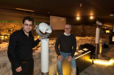
从2018年12月5日至7日,欧洲航空测量行业的代表聚集在丹麦哥本哈根以北的埃尔辛诺/赫尔辛林,在第一次欧洲航空测量峰会上,以应对市场机会和挑战。丹麦工程公司Cowi及其地图部门是欧洲主要的Geodata供应商之一,在Hexagon,Riegl,Caeaviation和Teledyne Optech的赞助下主持了会议。该活动专门致力于讨论航空测量行业的状况,这是欧洲长期以来的首次活动。
Cowi地图部高级副总裁Simon Musaeus表示:“最初,我们渴望为整个行业提供沟通平台,以告知和了解改善协作和企业的选择。在宣布峰会之后,该行业的反应压倒了,这表明我们所有人(收购公司,行业供应商和公共机构)非常需要共同解决相同的问题。”188asia备用网址

这agenda was designed to give a holistic view of the environment and room for open discussion on all relevant aspects of today’s aerial surveying industry in Europe. Denmark counts among the countries with the best-developed geodata infrastructure in Europe. Adam Lebech, representative of the Danish Agency for Digitization, opened the conference with a warm welcome note and underscored the increasing relevance of data in general to the rapidly digitizing Danish society. From The Netherlands, another leading country in the use of 3D geoinformation and a long-standing benchmark for NSDI, Erik Nobbe, manager at in charge of the national imagery and 3D programme at HWS, shed light on the reality of present-day aerial surveying data capture.
Aerial mapping of The Netherlands
Every year, a full aerial survey of The Netherlands is conducted two to three times to satisfy the needs of a growing number of users for relevant information. On the other hand, the rapidly growing demand creates considerable challenges: the data capture is often limited to a particular season (e.g. ‘leaves on’ or ‘leaves off’) and, within this time window, can only be carried out in cloud-free conditions. Imagery capture additionally requires a minimum sun angle to avoid shadows, which means operating during the busiest hours of the day. With three very active international airports, Dutch airspace is one of the densest and most strictly regulated in the world, which makes it very difficult to gain access for survey purposes. Despite the importance of geodata collection for the government, it has become clear that the air traffic control authorities and regulations are not willing to prioritize the operations. Unfortunately, this is no exception in Europe.

Key requirements
关于该行业认为对解决至关重要的一般主题的讨论导致了峰会的亮点 - 这是一个研讨会,所有50名参与者都确定了当今社会和行业面临的最突出需求。在讨论变革的建议时,与会者确定了行动的几个关键要求,这些要求将强烈支持未来的数字社会,并为欧洲的创新行业创造可持续业务:
- 欧洲资助高分辨率和高准确性3D数据的大规模数据采集计划。一个很好的例子是北美3DEP
- Cooperation with and support from the civil aviation authorities to better prioritize aerial survey for the capture of geoinformation that is crucial for governmental planning processes
- To define, maintain and promote quality, safety, ethical and business requirements for the aerial surveying industry and provide certifications that are acknowledged Europe-wide to ensure a predictable quality and delivery of the data generated in a sustainable way
- Education of the decision-makers and the general public about the important role that high-resolution geodata from aerial survey plays on the route to digitalization.
这group of participants agreed unanimously to start the formation of an industry association. This body shall act as a professional counterpart to national and supranational funding agencies, promote the use of aerial surveying data, ensure sustainability of the services by certification, and serve as a platform for communication and cooperation among the industry stakeholders to enact positive change. The working group to prepare the formation of the association consists of Simon Musaeus (COWI), André Jadot (Eurosense), Rachel Tidmarsh (Bluesky), Giovanni Banchini (CGR), Florian Romanowski (Opegieka), Aicke Damrau (Geofly) and Klaus Legat (AVT). The target is to incorporate the association before the end of 2019.
这summit was brought to a positive close with words from Søren Reeberg of SDFE, who welcomed the decision and commented that positive cooperation with the industry is also expected from the public sector. The organizers and participants are now looking forward to the next European Aerial Surveying Summit later this year.

使您的收件箱更有趣。Add some geo.
Keep abreast of news, developments and technological advancement in the geomatics industry.
免费注册

