One Click, One Day, One Map
Expressmaps: Emergency Mapping Service
In the event of a major crisis, accurate and detailed maps are one of the first things called for by organisers of relief operations and coordinate field teams. Quick and easy access to such maps is also vital to meet the critical logistical requirements of prospecting, exploration and operations teams working in remote regions. EXPRESSMaps is a new service which will provide a range of detailed maps at a scale of 1:50,000, within six to twenty-four hours of being requested.
Map Content
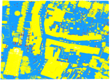
Those responsible for initially responding to emergencies require base-maps of a region as soon as possible. EXPRESSMaps supplies maps at a scale of 1:50,000, chosen to match the inherent accuracy of the source data and the current accuracy of GPS receivers (e.g. Figure 1). This universal scale means maps can be used reliably on the ground and have a footprint of roughly 600 square kilometres, depending on the latitude of the requested area. Map content has to cater for a range of uses, e.g. by field teams, crisis-management units, humanitarian aid organisations, logistics companies and security players. Content is a trade-off between two key constraints: source data and timeliness.
Source Data
ExpressMaps的几何精度完全取决于源数据。截至2009年中,覆盖范围跨越了1亿平方公里,包括超过75%的地球地面(没有美国和加拿大)。由于云的不断存在,靠近赤道的区域尚未完全覆盖。美国,加拿大,英国和北欧也尚未涵盖,但可获得准确的地图。亚洲将在接下来的几个月内进行映射。
The area covered by the service corresponds to off-the-shelf orthorectified Reference3D [website 1] and SPOTMaps [website 2] satellite imagery from Spot Image. Reference3D and SPOTMaps data are reliable and have been evaluated and validated by numerous domain experts. Reference3D combines a Digital Elevation Model, a 5-m resolution ortho-image in black & white, and other quality information. SPOTMap is an ortho-image in natural colour at 2.5m resolution; both are based on SPOT5.
Rapid Mapping
The second constraint relates to ensuring map production within six hours of receiving a request. An innovative feature of the service is that the entire map production process is patented. Each step is optimised and timed to ensure prompt delivery under all circumstances, whatever the area of interest, whenever a disaster or emergency occurs.
Detailed Specs
每个映射满足相同的规格和要求ments, whatever the region or delivery deadline:
absolute vertical accuracy: 10m CE90 (i.e. for 90% of the data) for slopes < 20°
absolute horizontal accuracy: 15m CE90
contour spacing: 50m
scale: 1:50,000 (for files intended for printing)
projection: UTM WGS84
geographic and UTM coordinates
产品足迹:纬度50°S和50°N之间的15'x 15';50'70°S和50'70°N之间的15'x 30'。
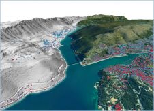
Each map delivery (e.g. Figure 2) comprises a set of files which are compatible with a range of programs, including any GIS tool on the market, any freeware viewer, Google Earth and web-based services through a geoserver.
Operational Legend
由于旨在适合生产约束的传奇,因此很容易解释地图内容。主题和技术规范在很大程度上取决于该领域的地图。选择每个信息的信息是为了帮助地面上的人和团队尽可能轻松地找到自己的出路。
Transportation
地面运输网络是输入的第一层。这是在数据提取过程中受到最大关注的地图元素之一。绘制了两类道路或轨道:主要路线和其他路线。两者之间的区别不是基于技术标准(道路表面,车道数等),而是基于它们作为通信线的相对重要性。最宽,最常用的路线以及连接最大村庄或城镇的路线被归类为主要路线。从轨道到次要道路,所有其他人都被归类为其他路线。这种不寻常的分类方案取决于需要快速提取信息的需求,并且映射的景观和道路网络密度可能会发生巨大变化。例如,如果将所有停机路道路归类为主要路线,而所有其他道路则归为其他路线,则某些地图只会显示一个类别,因此使用有限。同样,该方案适用于许多实际路线实际上是泥土轨道的许多领域。因此,ExpressMaps分类具有功能性,突出了主要路由,以帮助团队尽可能快速,轻松地到达目的地。
其它功能
Populated areas also receive special attention. The population layer comprises five classes, three of which are reserved for types of housing. Classes are distinguished according to housing density. Two additional classes cover industrial or trading zones in built-up areas. Large areas are represented by polygons, while points enable large buildings such as warehouses and factories to be quickly identified. Such landmarks are useful for navigation.
关于地图的其余信息是由于源数据特征,所选量表(1:50,000)和生产时间限制之间的细节水平之间的权衡而产生的。例如,其他领域的土地占用率是由十个其他类别提供的。桥梁,水坝,机场和港口等许多点功能也被绘制,以促进地面运营使用。地形由轮廓为50米的轮廓和阴影表示。还显示了从DEM提取的高和低点(在每个地图上大约八十个)。与地形地形有关的此类信息可以使该领域的进度更快,更快。
Concluding Remarks
ExpressMaps(图3)建立了一组适用于全世界景观的规格和生产程序。它可以在一天以下的地图生产中为用户提供几乎所有观点的1:50,000地图的能力。与客户进行交流的特定资源缩短了流程并平滑工作流程,以确保在记录时间内的地图生产:专用网站[网站3]允许用户单击几下单击的帐户,预付一年的地图预付款通过专门设计的界面来满足他们的需求。
致谢
Thanks to Marc Bernard and Myriam Chikhi from Spot Image SA for help in designing the service EXPRESSMaps.
Make your inbox more interesting.Add some geo.
Keep abreast of news, developments and technological advancement in the geomatics industry.
Sign up for free

