Obliques
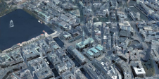
In conventional aerial photogrammetry, the camera axis is directed in the vertical so that the images are taken more or less parallel to the terrain. Extracting accurate geometry from images taken with the camera axis directed between the horizontal and the vertical – obliques – has been restricted for a long time, both technologically and computationally. Using these images, calculating a building’s height from the flying height, the focal length and the camera depression angle is labour-intensive and difficult to automate. Hence the development of technologies for mapping the Earth’s surface focused on vertical images measured stereoscopically. Today, processing obliques has become a piece of cake, since complex transformations can be conducted with the help of the computer, and additional data sources such as Digital Elevation Models (DEM) provide a means to include the third dimension. The oblique camera systems developed in the last decade take five images at a time: one directed nadir and the others viewing forward, backward, left and right.
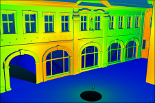
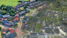
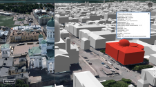
斜描绘的垂直扩展内置的gs, bridges and other structures clearly, and show them from a viewpoint which is familiar to everyone. Their main advantage compared with vertical images is better and more intuitive interpretation and, when combined with computer-assisted measurement tools, a large, non-professional user group can retrieve distance, height, area and volume of any object. Municipal officers, for example, can register the number of storeys of a building and determine its height, volume and the shape of its roof without even leaving the office. Such information is beneficial for property taxation and issuing building permits. Fire brigades can rapidly determine how to access a building through the back garden if the front appears blocked. Within a land administration and management context, obliques allow identification of (general) property boundaries, building registration and better communication from government to citizens. National mapping agencies may enjoy the creation of richer topographic databases while reducing incidences of objects being mislabelled, since parts of buildings, level crossings and other vertical structures that are occluded in vertical imagery are visible in obliques. And when georeferenced, they become very valuable for highly automatic creation of 3D city models. From airborne Lidar, terrestrial laser scanning and planar maps of streets, the block structure of buildings can be determined. Since they are georeferenced, the building facades’ outlines can be projected into the obliques, then cut out and glued onto the facades, thus enabling automatic draping of texture. However, obliques should be regarded as complementary to traditional photogrammetry for mapping purposes rather than as a replacement for it.
So do obliques have no flaws? On the contrary, they do. Stereoscopic viewing is often troublesome owing to the great variations in scale in a single image. And in obliques taken at low flying height, trees and buildings may obstruct the view of objects of interest.
Make your inbox more interesting.Add some geo.
Keep abreast of news, developments and technological advancement in the geomatics industry.
Sign up for free

