Insights into GIS Data - GeoCom17
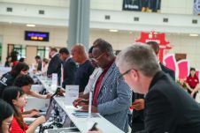
An impressive line-up of speakers climbed the stage of the Royal Geographical Society in London, UK, on Thursday 26 October for the AGI Annual Conference, GeoCom17. Professionals in the geospatial data industry gathered to hear the newest developments and learn about the offerings the industry could contribute. There also was time for honours as Rollo Home received the AGI Chairperson’s Award for Outstanding Service and Diana Murray was presented with the AGI Award for Career Achievement.
The theme of the day was ‘Smart Geospatial’ and this was highlighted by Editor of Techworld Charlotte Jee who highlighted challenges that are existing in a world that is more and more relying on IT – and the solutions that this may bring. On one hand, there are the flying taxis starting to operate in Dubai, whilst during a presentation of the newest iPhone, the face recognition failed. In the panel, she welcomed John Abbott of HM Land Registry who gave an insight into the amount of data they are collecting and at the same time making accessible. The organisation also is very aware of new technologies and exploring ways to make the best use of them. Owain Hale-Heighway of Gaist Solutions demonstrated the challenges and solutions in road mapping and maintenance. Especially the capturing of data to know about the current situation has his attention – Gaist is exploring methods to use for example bin lorries and governmental vehicles that are using a known network to achieve an up to date database. Lisa Woodall of Ordnance Survey was impressed by the advances Google Maps was making, according to her, incrementally by sourcing data from other organisations and including them. “We need to collaborate”, was her conclusion.
New Approaches
The second forum of speakers included David Johnson of ONS Data Campus – he is preparing the campus for a formal launch and showed the audience different ways to look at data. For example, to overcome the challenge of false positives in urban areas for trees in satellite imagery, they developed a way to use Google Streetview to estimate their number. “We are not geospatial specialists and we need professionals to work together”, was his conclusion. He was followed by Dr Helen Ferrier who outlined the amount of data is used to optimise agriculture. However, data is only valuable if you can turn it into information – and do this fast. Communication and telecom connections are the challenge as coverage of the countryside for data transmission should be improved. Philip Graham, CEO of the National Infrastructure Commission, gave an insight in the relation between the real world and policies that touch infrastructure in surprisingly many ways. How can you anticipate and work with these relationships and be prepared for the future?
After the lunch break, supported by 1Spatial, four businesses shared in 7-minute talks their recent insights and developments, all of them making use of geospatial data, or creating it. Javier de la Torre, CEO of CARTO, demonstrated that ‘everything is going to be geospatial’ and even streaming: data visualisation has his strong attention and he gave examples of uses of new developments.
Keynote speaker of the day was Prof Kate Jefferey. She linked neuroscience to navigation: how do people use their brains for navigation and will people that rely more on navigation develop this in their brains? She showed which parts of the brain are working hard to give consciousness of where people are and where they are going. For cab drivers, research shows that certain parts of the brain are effectively more developed due to their daily navigation activities.
Cornerstones of the GIS Profession
AGI Chair Abigail Page was honoured to present the AGI Chairperson’s Award for Outstanding Service to Rollo Home, former AGI council member who had contributed to several AGI Conferences. He also coached professionals in their career and within the AGI. “He showed a new level of ambition”, was Abi’s motivation for the inspiring personality. She also presented the AGI Award for Career Achievement to Diana Murray for her significant long-term contribution to the industry during her career where she contributed to link geospatial information to history and archaeology.
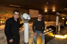
After these official moments, time came for the informal networking during the GeoDrinks that were sponsored by Europa Technologies – one of the partners of the event. They were showing the developments in the exhibition that had the attention of the delegates during the breaks and during the drinks, as an opportunity to see what new developments are available and how they can use it in their daily practice.
This article was published in GIS Professional December 2017
Make your inbox more interesting.Add some geo.
Keep abreast of news, developments and technological advancement in the geomatics industry.
Sign up for free

