Industry Report: The Geospatial Industry is Alive and Kicking
How Digitalization and the Immense Need for 3D Data Drive the Business Forward
The advancement of new technology in the geospatial industry is opening up new horizons for surveyors. The profession has rapidly become high-tech, which has brought many benefits and also an ever-greater need to invest in advanced data acquisition, processing, analysis and visualization solutions. According to the findings from the annual 'GIM International'survey among geospatial professionals, the demand for such solutions is set to reach new heights in 2020 and beyond. It is a case of ‘full steam ahead’ for the surveying and mapping business – which is great news in particular for hardware and software companies.
The mood among this year’s survey respondents can safely be described as optimistic. There are several reasons for this, and they will be explored in more detail below. One respondent hit the nail right on the head, commenting: “We’re experiencing a growing need for the modelling of the geographical space, which requires mapping the environment – which means more work for us, resulting in our need to invest in equipment to capture and manage all this data.”
Economic situation and prospects
To put the current market situation into perspective, it helps to first zoom out and consider the macro developments. According to the most recent World Economic Outlook Update (January 2020), global growth is projected to rise from an estimated 2.9% in 2019 to 3.3% in 2020 and 3.4% for 2021. In line with the economic growth rate, Frost & Sullivan predict global spending in the architecture, engineering and construction (AEC) industry to rise to US$17.5 trillion by 2030. Additionally, Deloitte reports that the construction industry will be capitalizing on trends that help improve operations and deliver a competitive advantage, and overcome the challenges of cost pressures, labour shortages and trends toward fixed-bid projects. The adoption of digital technologies in the construction sector finally seems to be gaining ground. This is creating terrific chances for companies that are able to support the digital transition – and many of them are in our industry, since geospatial data is a vital pillar of this shift.
Blurring boundaries between geomatics and construction
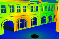
One survey participant from Canada noted that technical surveying levels in construction are low in Canada and the potential of GIS in this sector is still underutilized due to a lack of awareness. Meanwhile, a consultant from the USA stated that the construction sector still is too “old fashioned” and reluctant to try geospatial technology. Nevertheless, the digital transformation is creating a growing need for both geospatial data and geospatial knowledge in construction, and the blurring of the boundaries between the AEC sector and the geospatial industry is opening up a multitude of new opportunities for geospatial professionals. Surveying skills are essential in order to capture a whole range of crucial measurements with the necessary precision – not only during the planning and construction phase, but also throughout the entire life cycle of buildings.
However, the rapid rise of构建信息建模(BIM) is increasingly changing the way that surveyors work. BIM is helping to boost the popularity of laser scanning to provide the data that project teams need. In a nutshell, this is where manufacturers of Lidar solutions come into play and why their business prospects look very promising. Competition is fierce, however, as new kids on the block are snapping at the heels of the traditional laser scanning companies in their enthusiastic attempts to disrupt the market with new and usually cheaper solutions.

Growth in AEC, infrastructure and urban planning
In the188金宝搏特邀study, a relatively high number of surveying companies mentioned the AEC and infrastructure markets as areas where they foresee the biggest possibilities for business growth. The rising demand for the acquisition and management of high-quality geospatial data to support the development of infrastructure – railways, roads, telecom, etc. – is creating an abundance of chances. There is also an increasing number of national mapping projects around the world. In a very extensive project in Japan, for example, Mitsubishi Electric backed a consortium engaged in developing high-definition 3D map data of all the country’s highways, while also providing much of the key technology. Meanwhile, Malta is using unmanned aerial vehicles (UAVs or ‘drones’) to conduct a nationwide survey aimed at developing a new orthophoto map database. The data will be used to evaluate the state of the country’s roads as part of a seven-year, €700 million government investment project to upgrade the quality and safety of the Maltese road transport infrastructure.
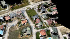
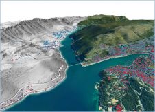
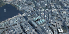
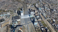
Now that 3D spatial data infrastructures are becoming the standard, the demand for 3D city models is set to bring lots of work opportunities for survey and mapping companies. Recent developments in what is called ‘hybrid aerial mapping’ – in which three sensor types are combined in a single geodata acquisition system – are taking the creation of such 3D models to a new level. This approach is opening up new possibilities for large-scale projects, as illustrated by recent aerial surveys conducted in major cities across the UK and Ireland, for example.
Growth in land administration
Another application that is regarded as holding great potential is cadastral mapping. According to analysis by the International Federation of Surveyors (FIG) and the World Bank, only around one quarter of people’s land rights across the world are formally recognized by cadastral or other land recording systems – so there is clearly lots of work still to be done! Fortunately, a growing number of national governments – often supported by experienced national mapping agencies from countries with a sophisticated cadastral system such as The Netherlands and Sweden – are launching initiatives to recognize and register land rights for all. As a result, modern land administration methods based on GNSS receivers for consistent and accurate spatial data collection are being embraced by surveyors, the private sector, policymakers, governments and communities alike.
All the leading manufacturers of measuring, surveying and mapping equipment such as Hi-Target, Leica Geosystems, Pentax, SOUTH, Topcon and Trimble offer a broad portfolio of tools and customizable solutions that enable surveyors to map cadastral boundaries. However, there is also a growing demand for low-cost and scalable mapping alternatives aligned with fit-for-purpose land administration. This need is driven by the enormous scale of the task on the one hand, and the fact that sophisticated survey methods may be too expensive for many governments on the other. The UAV-based mapping of land tenure inspired by state-of-the-art approaches from remote sensing, geoinformatics and computer vision is a good example of one such solution. According to the latest research, about 90 countries lack land registration systems while a further 50 countries are in the process of establishing such systems. Therefore, it is no surprise that a significant number of geoprofessionals who participated in our industry survey see a lot of potential in land administration-based mapping projects.

UAVs: A proven game-changer
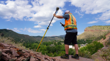
Both theAECandland administrationsectors have significantly benefited from the emergence of the drone as a mainstream surveying tool over the past decade. The advantages of UAVs over traditional survey methods include faster data collection over much larger areas and high-precision positioning, to name but a few. But even though the UAV market may have matured, there is still plenty of room for further growth. Now that many companies have discovered and embraced the benefits of unmanned mapping, they are investing more not only in drones, but also in the various collection techniques that they can be used for. One of the survey respondents commented: “As a surveying tool, drones are fast becoming the most efficient way of mapping larger areas. With UTM (unmanned traffic management, Ed.) andBVLOS(beyond visual line of sight, Ed.) operations on the horizon, we are going to see some great technology in the next few years.”
参与今年的调查计划投资无人机技术的大量地理专业人士,高端和低端解决方案都引起了极大的兴趣。关于后者,来自Ivory Coast的一家测量公司的所有者说:“我们计划将廉价的无人机介绍到非洲市场。我们希望在2020年中期部署我们的战略。”无人机映射的应用经常提到的应用包括地形调查,采矿,会变地图,农业和建筑。根据奥地利领先的建筑公司Strabag的说法,无人机是测量师工具箱的重要补充,将在建筑行业的数字化转型中发挥重要作用。
Interest in UAS-Lidar
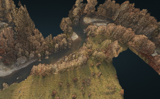
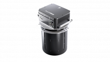
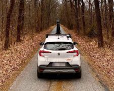
The increasing use of Lidar and unmanned aerial systems (UASs) is expected to converge in what can conceivably be labelled as ‘the next big thing’ in the aerial mapping sector: UAS-Lidar. Laser scanners have tended to be substantially heavier than cameras, so it has taken a few years to successfully equip drones with survey-grade time-of-flight Lidar sensors. But nowadays it is possible to buy UAS platforms with integrated laser scanners and an IMU featuring full-waveform recording, scan rates of up to 1MHz and centimetre-level precision – and some of them weigh less than 3kg.
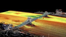
转向混合动力驱动的映射need for the fast capture and delivery of high-accuracy aerial imagery and Lidar data as the basis for 3D modelling. Airborne Lidar and photogrammetry are both viable methods for capturing point clouds for 3D modelling. Manufacturers and suppliers of UAS-Lidar solutions will undoubtedly be delighted to hear that our survey revealed a surprisingly high level of awareness of the benefits of hybrid aerial mapping and considerable interest among our readers. “We are looking at new survey-grade UAV and Lidar processing software,” and “We plan to invest in lightweight, compact and integrated UAS-Lidar for our 3D modelling and mapping projects,” are just two examples that summarize customers’ readiness to invest in this high-tech way of mapping the world.

Volumes of geodata
作为数据捕获技术进步的直接结果,我们每天生产的Geodata量正在达到新的高度 - 并且在可预见的将来将继续这样做。Thanks to the availability of the massive computational power needed to process it, this abundance of geospatial data is increasingly being combined with artificial intelligence (AI) – resulting in ‘geospatial AI’ which has the potential to transform the future in countless exciting and as yet often unimaginable ways. AI techniques can be used in a variety of geospatial applications, such as remote sensing for Earth observation and spatial data analysis. Image recognition and analysis from satellite-derived geospatial information is one example of how AI has been widely used to exploit the value of geodata over recent years. For instance, the European Space Agency (ESA) derives key geoinformation products from Earth observation (EO) data in support of urban planning tasks. Other new AI approaches for EO could include the automatic learning of satellite data formats, increasing satellite autonomy for 3D real-time analysis and monitoring, and using AI to infer geolocation data from disparate data sources. There are also real-life examples of machine learning – a subset of AI – being used to handle geospatial data, e.g. in the classification of Lidar point clouds by means of deep learning.
Perhaps unsurprisingly, 34% of the respondents in our survey indicated they would like to see more coverage of artificial intelligence in our magazine, and 38% asked for more insights into big data. “Projects will be automated using data capture with point clouds and processed with artificial intelligence,” one respondent suggested. Another made the following prediction for AI: “Geomatics and GIS won’t be separate topics or professions anymore. AI will completely take over imagery analytics, among other things.” With datasets becoming ever larger and more complex, however, it is safe to say that AI will present more opportunities than threats from the geoprofessional’s perspective.

In the mood to invest
When asked whether their organization plans to invest in new systems in 2020, two thirds of the survey respondents answered affirmatively. The top three investment areas are GIS software (45%), UAS for mapping and 3D modelling (41%), and GNSS receivers (40%), followed by terrestrial laser scanners, point cloud processing software and – climbing the charts –UAS-Lidar systems. Manufacturers of total stations do not need to worry, though; more than a quarter of respondents intend to purchase new total stations.
Compared to last year’s survey, substantially more respondents indicated that they plan to replace or upgrade existing survey equipment this year, which will surely be encouraging news for many readers of this article. The need to replace outdated equipment is the primary motivator, but another reason given for spending money on new technology is the awareness of the possibilities offered bynew hardware and software solutions. The bottom line is: based on their investment plans, geospatial professionals are optimistic about the future.
瞥见未来
That optimism does not always extend to the future role of surveyors themselves. “I foresee the profession will continue degrading, with fewer professionals and more unqualified people in the business,” commented one of the respondents. On a more positive note, a fellow surveyor envisions the profession of surveyor will be rebranded as a kind of ‘digital reality specialist’. Some geoprofessionals see5Gas a new game-changer and believe it has the capability to change the future of surveying. It will enable vast amounts of Lidar data generated by state-of-the-art laser scanners to be processed in the field, with the point cloud data being uploaded to cloud services for processing in real time. It will be interesting to see how people’s views of 5G have changed by the time of next year’s survey on the state of the geospatial surveying industry!
Once again, our survey reminded us that the huge impact of geospatial data on everyday life cannot be underestimated, and many more exciting opportunities lie ahead. However, most members of the general public are still unaware of the importance of our profession in society. Therefore, it remains crucial that we are all ambassadors of the beautiful surveying profession! There is a strong need for us to engage with the public, businesses, policymakers and youngsters in order to attract much-needed new talent to our sector, now and in the future.
Further Reading
World Economic Outlook(January 2020)
德勤,2020 Engineering and Construction Industry Outlook
Traxler C., Hesina, G.Interacting with Big Geospatial Data,188金宝搏特邀
Paul Hahn,Three Trends Driving the Geospatial AI Revolution,The European Business Review
Make your inbox more interesting.Add some geo.
Keep abreast of news, developments and technological advancement in the geomatics industry.
Sign up for free


