From the Depths of the Ocean to the Surface of Mars
GIM International Interviews Allan Carswell
Canadian Lidar company Optech originated in 1974 as a spin-off from Allan Carswell’s research at York University in Toronto, where he had initiated one of the first Lidar research programmes. GIM International recently took the opportunity to interview to the founder and chairman, who can be described as a true Lidar pioneer. Here, he talks about Optech’s 40 years of leadership in transforming Lidar systems from virtual obscurity into systems that are revolutionising diverse fields such as surveying, 3D imaging and active and passive optical remote sensing.
Can you tell our readers about the start of your career and the foundation of your company?
I joined the faculty of York University in 1968, and started an atmospheric Lidar research programme to combine my previous laser experience with York’s strong atmospheric science programme. Ontario Hydro was supporting the use of the York Lidar to map the smoke plume from a new coal-burning power station equipped with the latest pollution controls which made the plume invisible to the eye. These studies were so successful that Hydro decided to purchase a Lidar of its own in 1974. Since I was unable to respond via the university, my wife Helen and I decided to set up Optech instead. Our bid was accepted, we hired a couple of former York colleagues, and Optech was on its way. When the Lidar was delivered, it was probably the first commercial sale of a Lidar ever made.
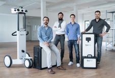
在大学,我还开发了一种激光雷达for underwater applications using a pulsed argon ion laser operating in the blue-green spectral region. During shipborne Lidar studies on Lake Erie in 1973, this system had shown very attractive capabilities, including water penetration to depths of 20m. This led Optech to receive the support of the Canadian Hydrographic Service (CHS) and the Canada Centre for Remote Sensing (CCRS) to assess the potential of Lidar for airborne bathymetric measurements. Since then, Optech has grown from a small family business into a member of the international Teledyne team, with a staff of over 200 and worldwide recognition as a leader in the development of Lidar and remote optical imaging systems. In May 2014 we celebrated our 40thanniversary with over 500 staff and family members at a weekend Family Conference at Niagara Falls (see Figure 1).
How has the company evolved over the years?
In the early years Optech was mainly a contract R&D business, focusing on the development of atmospheric Lidar and the advancement of the technologies needed for airborne Lidar systems, and R&D continues to be an important component of our business to this day. The market for atmospheric Lidar has mainly been for one-of-a-kind systems with unique capabilities, developed for specialised applications such as air quality and meteorological applications. One Lidar used Raman scattering in the ultraviolet spectrum to measure the concentration of methane in natural gas at ranges of up to one kilometre. Several of our atmospheric systems were major ground-based Lidar facilities for studies of the stratosphere, using differential absorption to measure the ozone concentration and Rayleigh scattering to measure temperatures and gravity wave structures to altitudes over 70km. The highlight of our atmospheric Lidar work came when Optech was selected by NASA to provide a Lidar to study the atmosphere of Mars as part of the 2007 Phoenix mission. This Lidar, the first to operate on the surface of Mars, worked for over five months at temperatures down to -100C° and mapped the structure of the Martian atmosphere up to altitudes of 20km. These measurements proved that it snows on Mars – a new and important aspect of the Martian hydrological cycle.
A major step forward in airborne Lidar came in 1977, with Optech’s development of an airborne laser ice profilometer for the ice reconnaissance branch of Environment Canada. This system was used to obtain statistics about the surface roughness of the ice, since experience had shown that this information was of high value in understanding the nature of an arctic ice field. Thus, high-resolution absolute positional information was not mandatory for the Lidar ice profilometer. This situation offered a unique opportunity for us to obtain extensive operational experience with airborne laser surveying almost two decades ahead of the availability of GPS in the 1990s.
Optech is specialised in products for use on land, at sea and in the air. How important is hydrography as a pillar for your company?
Since the advent of dependable blue-green lasers in the 1970s, Optech has maintained a special focus on the development of airborne Lidar bathymetry systems and has delivered many systems to an array of international users for measuring the depth and water column characteristics of inland and coastal waters around the world. For example, our first operational airborne Lidar bathymeter, the LARSEN 500, was delivered to the Canadian Hydrographic Service in 1984 and was used to produce Canadian Chart #7750 of Cambridge Bay in the Canadian Arctic, the first hydrographic chart created using airborne Lidar bathymetry. FLASH was delivered to the Swedish Defence Institute (FOA) to detect submerged objects, while ALARMS, a scanning system for the detection of underwater mines, was developed for the U.S. Defense Advanced Research Projects Agency (DARPA) during the first Gulf War in 1988. This was a most unusual airborne system, since it used a copper-vapour laser operating at a temperature of around 1,500C° to produce multi-kHz output at 510nm.
We have many years of collaboration with the U.S. Army Corps of Engineers (USACE) in the development of hydrographic Lidar systems, beginning with development of the 200Hz SHOALS-200. Originally installed in a Bell 212 helicopter, in 1988 this system was upgraded to a SHOALS-400 and outfitted for operation in a Twin Otter fixed-wing aircraft. In 1994 and 1995 Optech delivered two HAWKEYE systems to the Swedish Hydrographic Department and the Swedish Navy. During the 2000s we continued the development of commercial bathymetry Lidar with delivery of the SHOALS-1000 to the Japan Coast Guard. This system collected 1,000 water-depth soundings per second with IHO Order 1 accuracy at coverage rates of up to 70km2/hour. SHOALS was subsequently upgraded to CHARTS, a system capable of 3,000 depth soundings and 20,000 topographic measurements per second, which was delivered to the US Navy and the Arab Emirates Survey Department.
Read the full interview in the May/June Issue of 2015, page 13.
Make your inbox more interesting.Add some geo.
Keep abreast of news, developments and technological advancement in the geomatics industry.
Sign up for free


