Creating a Smart Nation: the Geospatial Approach
How Geodata Can Enhance Governmental Operations
These five practical examples from Israel illustrate the role of governments, spatial data and technologies in developing a smart nation.
The Fourth Industrial Revolution brings about new advancement and abilities in geospatial technologies. This article focuses on the use of these new technologies to support the creation of a smart nation in Israel. Specifically, the article is based around three questions: What is a smart nation? Why should governments get involved and invest in developing a smart environment for a smart nation? And what is the role of spatial data and technologies in a smart nation? These questions are answered and explained using five practical examples, including a recent one on minimizing the spread of COVID-19 using geospatial technologies.
Over the last century, the Third and Fourth Industrial Revolutions have transformed society into a knowledge-based society. Today, people and organizations are connected and surrounded by sensors and technologies that make daily operations more efficient and convenient (i.e. smarter). Driven by their citizens’ needs, governments all over the globe are seeking to make their nations smarter.
It is often suggested that a smart nation functions according to the following formula:collaboration + data + analysis = performance.
Collaborationis the exchange of know-how, data and services which is happening between and across governmental entities, with local authorities, with businesses, with citizens and even with connected sensors (i.e. Internet of Things).
Datais collected using various methodologies (field surveys, remote sensing, data harvesting from operational systems, crowdsourcing, etc.) and in various formats (raster, vector, three-dimensional, unstructured text…). It should be readily accessible available for all interested parties.
Analysistransforms data into intelligence, providing tools for identifying uneven resource allocation, delivering an efficient operational plan, suggesting remedies for different problems, and predicting outcomes based on the given information. Andperformanceimprovement is the ultimate goal. Processes are becoming more efficient thanks to better coordination and better decision-making. This saves scarce resources and upgrades the standard of service to citizens.

This formula corresponds to the graph in Figure 1 which shows that the best value from using information technologies is gained by optimizing processes and workflows using data analysis.
Real Estate Database Creation
This principle is demonstrated by the example of the ‘Real Estate Database Creation Project’, which was initiated by the Israeli Government’s Decision 374 in June 2013. It evolved from a massive public protest on the shortage of houses in Israel and the high rent prices. The project goals were twofold: 1) To reduce uncertainty in the housing market by publishing reliable and comprehensive information about properties and their prices in order to decrease speculation and burst the economic bubble, and 2) To improve collaboration among governmental agencies and expedite operations aimed at the creation of more housing units (thus increasing supply) by using geospatial technologies
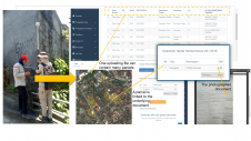
The project has successfully accomplished its goals over the last six years. Firstly, a national real-estate database has been created. This database was integrated from four key resources (Figure 2):
- Topographic data from the Survey of Israel’s national spatial database, collected automatically as described in Keinan et al 2016.
- Alpha-numeric governmental data collected from operational systems.
- Expert sourcing data collected from maps produced as part of the construction process as described in Bekker and Felus 2019.
- Web data that was harvested from internet resources such as online real-estate marketing agencies, advertisements, websites, newsletters, etc.

These data sources were integrated into a national real-estate database using the different location attributes (address, address synonyms, parcel numbers, place names, coordinates, etc.).
Secondly, a geospatial portal was developed to present the data analysis in a user friendly interface through mobile and desktop devices (see Figure 3).
The ‘Real Estate Database Creation Project’ achieved its goal of providing data analysis for citizens, businesses and public entities so that they can make smarter decisions.

Why governments (rather than only cities) should lead the efforts to use smart technologies
A smart nation is composed out of smart cities and smart rural areas. However, small town and villages frequently lack the necessary knowledge and manpower to adopt advanced technologies and manage their area smartly. A situation in which small towns lag behind and provide poor services is unacceptable for a modern nation.
National Infrastructure Information Hub
为了解决这个问题在以色列,Isr的调查ael developed a basic set of IT components which will serve small towns and villages. This infrastructure should be modular enough so it can scale up with additional resources to fit large cities. The ‘National Infrastructure Information Hub’ project was initiated by the Israeli Government’s Decision 1074 in January 2016. The project is aimed at using smart technologies in infrastructure development activities. It works on a national level as well as on a local level (i.e. in small towns and villages) and it includes all types of infrastructure: electrical power, water, drainage, sewerage, oil, fuel and gas, communication and transportation. The project was very successful and achieved the following milestones:
- A strategy was developed by a national forum of infrastructure entities (governmental agencies, public organizations and private companies).
- A national standard for infrastructure data exchange was approved. The standard includes all types of maps (planning, building permits, as-built…).
- Data was acquired from all the infrastructure entities in Israel (government, public and private) – more than 80 organizations. This data has been improved and integrated into a unified national database.
- The integrated database is now being disseminated to the infrastructure forum in a secure manner and according to the specific needs (area and layers).
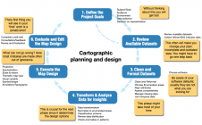
- A coordination system is being developed for the infrastructure activities which will include four steps as presented in Figure 4.

The success of the ‘National Infrastructure Information Hub’ project has encouraged the government to invest more resources into this effort and continue the development of smart spatial tools for infrastructure management.
Why a GIS plays a critical role in smart nation activities
Location information is a key attribute that can link datasets from many governmental entities and of many fields of activities. The following examples demonstrate these geographic information system (GIS) functionalities as they are used to make governmental processes more efficient and smart. These examples were developed by the Survey of Israel in collaboration with the Israeli Inter-Ministerial Committee for GIS as modules in the Israeli geospatial portal (developed using Esri software).
How to promote sport and a healthy lifestyle
A collaboration between the Ministry of Culture and Sport and the Survey of Israel has created a methodology for efficient management of the construction of 2,000 new sport facilities, thus promoting sport and a healthy lifestyle in Israel. The sports facilities have been built by local authorities with the financial support and approval of the Ministry of Culture and Sport.
A system was designed using the national geospatial portal with a spatial database that contains all the information about each sport facility (location, purpose of the facility, capacity in each activity, parking spaces, contact person, and even schedule of sport classes. The system is an efficient tool for sharing information about each sport facility and activity among government entities, local authorities and citizens. Moreover, the system has smart tools to analyse the need for sport facilities according to demographic information. This analysis makes it easy to identify gaps (areas with a shortage of sport facilities based on the local population) or duplications and unneeded facilities.
How to support water conservation
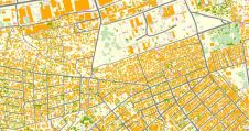
In collaboration with the Water Authority, a new GIS module was developed to analyse water needs for green-space maintenance purposes. Each city and local authority use the module to map green spaces and their attributes (grass, flowers, trees) as shown in Figure 5. Based on the map, the estimated water consumption needs are calculated and approved. This allows each city and local authority to evaluate if water is utilized smartly and analyse whether there are any problems with the water network (pipeline leakage), whether there is a need to re-evaluate the maintenance plan, etc.

How to minimize the spread of coronavirus
Strong collaboration between the Ministry of Health, local authorities, police and the Survey of Israel has led to a number of smart spatial tools to assist in minimizing the spread of COVID-19. First is an online map of COVID-19 exposure locations (i.e. sites visited by infected people). This map was used by local authorities to disinfect the exposed areas and analyse the spread over time. Second is an online choropleth map which show areas with a high concentration of people infected with COVID-19. In these areas, the police closely monitored places where people could gather (synagogues, churches, parks, sports facilities and so on) or even enforced a complete lockdown. Maps with all the information are being used by the police to manage the operation and set up road blocks. These tools were used successfully in the first wave of the COVID-19 outbreak and they are currently in daily use in the struggle to reduce the spread of the virus.
结论
The ability to share knowledge, technology and data across all governmental organizations is critical to a smart nation. Geographic information systems provide the ideal platform to facilitate these collaborative activities. The examples above show the huge benefits when public bodies collaborate using GIS and spatial data. A smart nation needs smart tools to analyse the data streaming from multiple resources. This article has presented tools for data integration, for analytical calculations and for providing organizations with business intelligence. Lastly, the ultimate goal is to improve performance and make governmental processes more efficient and cost effective. The examples above show how geospatial technologies can enhance governmental operations, thus making a nation smarter.

Further reading
- Bekker,即胚胎,Y(2019)。质量控制佛r Crowdsourcing Large-scale Topographic Maps,Arch. Photogramm. Remote Sens. Spatial Inf. Sci., XLII-2/W13, 1201-1205,https://doi.org/10.5194/isprs-archives-XLII-2-W13-1201-2019
- Gartner's analytics maturity model (2016),https://www.zdnet.com/article/data-to-analytics-to-ai-from-descriptive-to-predictive-analytics/
- Keinan, E., Felus, Y. A., Tal, Y., Zilberstien, O., and Elihai, Y (2016). Updating National Topographic Database Using Change Detection Methods, Int. Arch. Photogramm. Remote Sens. Spatial Inf. Sci., XLI-B7, 529-536,https://doi.org/10.5194/isprs-archives-XLI-B7-529-2016.
- Israeli geospatial portal,https://www.govmap.gov.il/?c=204000,595000&z=0&lang=en
Make your inbox more interesting.Add some geo.
Keep abreast of news, developments and technological advancement in the geomatics industry.
Sign up for free


