City Map to Virtual Reality
3D城市重建模型
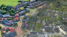
3D城市模型,正如我们今天所知道的那样,来自传统城市地图。使用计算机模型重建历史建筑的重建不仅依赖于传统的模型制造商的艺术,而且更多地依据创建城市地图的艺术和技术。城市地图始终是建筑研究的资源,并创建3D重建。作者介绍了用于使用地图的使用来创建城市的3D重建。
The reconstruction of historical architecture using computer models relies not only on the art of the traditional model-maker, but still more on the art and techniques of creating city maps. 3D representations of cities are made for purposes such as archaeological research, historical reconstruction, tourist and educational information, and urban planning. As such, they may simply display basic outlines and mass volume, distinguishing built-up areas from open areas (wire model), or they may be rendered in detail. In building a historical 3D model from maps one may set out either from the present state, using accurate current maps and interpreting changes retrospectively or one may take old maps and compare them to current ones. In using historical sources it is important to know and interpret the purpose of the original map, whether a fortification, historical, news, commercial or judicial map, a design or plan, or whether it concerns cadastral and GIS-mapping, terrestrial or aerial images. The extraction of useful data requires determination of the level of accuracy and reliability of each of these maps, analysis of background information and comparison of the map with others and with written sources. Since 3D models will serve as sources for further research, documentation of sources and decisions taken during the modelling process is of crucial importance.
Space-time Models
在九十年代中开始作为简单的CAD模型的许多型号现在已被翻译成虚拟现实(VR)和GIS。例如,VR电影已经由意大利乌迪内的圣GIACOMO制成。访客可以走来走去,探索广场的纹理和空间。但大多数这些模型仅在时间上显示一个时期,通常是目前,而作为一个因素的时间实际上显着使3D模型中的信息组织复杂化。ARNHEM3D是一个项目,旨在可视化旧的ARNHEM城市,因为它在第二次世界大战中的破坏之前。最终结果将使用户能够回收一些城市失去的文化过去。
A project being run by Washington University in St. Louis uses interactive Web technologies to explore the history of the City of St. Louis and region. The VR model enables a journey through time on the streets of downtown St. Louis. The 1850s and the 1950s are the decades currently active. The Virtual City will grow richer in detail as the project is expanded in time and space. These space-time models have in common that they are built from simple blocks with textured facades; timeframes have been set up separately.
Level of Detail
With respect to detail, three basic types of 3D models can be distinguished.
- Low-level detail: for planning, general overview and basic educational purposes.
- 中级细节:带有建筑物和构建块的地形模型。
- High-level detail: includes texture mapping, light-and-movement effect, such as VR and radiosity, useful for close viewing small-scale reconstruction of monuments, individual buildings etc.
Many examples of highly detailed models of monuments such as churches, castles, and townhouses can be found on the internet. This level of detail is too high for modelling entire cities. However, it is feasible for small spaces that rely on much detail and realistic effects. One example from the early computer-graphics age is the detailed reconstruction of the Abby of Cluny in France.
Realistic rendering allows older manifestations of the Abby to be tested and compared with alternative images.
Academic Purposes
虽然大多数模型代表了一个城市的当前状态,但许多人是为了研究和传播历史城市环境的知识。在建筑中使用3D重建的早期项目是1993年重建二十世纪的城市和建筑开发的强化荷兰·赫斯登镇。Joan Blaeu(1649)的地图基于其尺寸为“重建”,如图所示。另一项研究是从1900年到1990年从1900年到1990年开始六相开发的3D重建。制造这些模型的目的是从1900年到1990年检测城市景观中的质量和建筑细节的变化。该模型基于完整的集合1943年的详细图纸和地图,就在第二次世界大战中摧毁了城市之前。颜色不是以现实的方式使用,而是为了区分砖和斑纹的建筑。特征的抽象可以是检测行为或发展模式的优势。这些型号担任建筑研究中的科学工具。
Laser Scanning
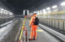
在新技术捕捉地形正无穷ormation and buildings, terrestrial laser scanning is a very promising one. For creating 3D models of the Palais Royal and Hotel Sully in Paris (MAP, Marseilles) no maps were used; digital 3D data was captured direct using laser scanning. The datasets were then combined, absent elements being given another colour and rendered transparent. These methods are very useful for capturing data from (partly) existing edifices, but fail where buildings are completely destroyed or when data is missing or turns out to be uncertain. In these cases we need to consult other visual and documentary sources for verification and reconstruct by inputting points and lines by hand. This was done by Derode for models of Utrecht Cathedral in The Netherlands, which display an advanced level of detail. Each consists of many polygons, shapes and colours. Light sources, texture mapping, radiosity and other rendering techniques make it look very real.
Final Remarks
3D models of cities are, just as the maps they are based on, only representations of the built environment: their content remains open to discussion. Interpretation of resources requires much knowledge concerning conventions to enable selection of accurate information. In addition, the level of detail and accuracy needed depends very much on the purpose a city model is to serve. Most current 3D city models show the present state of a city and in general there is very little information given about how the models were constructed, what maps were used as a basis, how accurate they were and on what points they were subject to interpretation. We are now seeing a convergence of techniques from traditional CAD models to VR Models and complex GIS systems. This marriage of techniques allows for general control of all levels, including those of documentation.
Make your inbox more interesting.Add some geo.
Keep abreast of news, developments and technological advancement in the geomatics industry.
Sign up for free


