Building a 3D Virtual Forest
Communicating Forest Management Plans through Virtual Reality
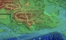
A forest management project in Quebec offers the local community a 3D virtual experience of the changes based on GIS data from a Lidar survey, as well as a digital elevation model.
森林管理计划是一个微妙的过程。Environmental, economic and social aspects need to be taken into account in order to achieve sustainable development. In Quebec, before a plan can be implemented, local communities have to be consulted for their feedback and concerns. Instead of just expecting citizens to decipher complex maps, this project is aimed at sharing a realistic view of the potential changes through a 3D virtual experience. This application is based on GIS data that consists of a shapefile with information derived from a Lidar survey, as well as a digital elevation model.
In the province of Quebec, Canada, the Ministry of Forests, Wildlife and Parks (MFFP) is in charge of the sustainable development of the forests. As part of its duties, the MFFP devises forest management plans. The initial plan has to be submitted for public consultation with the local population before any action can be taken. By holding such meetings, the ministry strives to keep the public informed, while taking into account citizens’ interests and opinions. In what is commonly known as the ‘harmonisation process’, the MFFP takes the feedback into consideration and, if possible, adjusts the forest management plan accordingly.
A communication problem
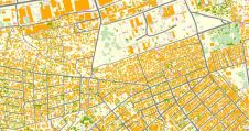
然而这个过程值得称赞,not always make it easy for citizens to form an opinion. Using the current technology, it is hard to visualise the real impact of the forest harvesting plans. This presents a communication problem for the forestry experts who are responsible for conveying the information to the residents taking part in the consultations. For example, maps offering an aerial perspective of the territory are currently being used to illustrate the various forestry operations. These maps are difficult to understand for anyone who is not familiar with this field of expertise. As such, for the vast majority of the population, these documents are not particularly helpful when it comes to visualising the final result in a practical manner – and yet how the end result will look matters immensely to many attendees of the consultation meetings.

A virtual solution
In an attempt to provide an answer to this communication issue, FPInnovations and the Centre en Imagerie Numérique et Médias Interactifs (CIMMI) joined forces to develop a virtual reality application called the Virtual Forest. An immersive and concrete way of visualising the result of forestry operations on a territory was created in the space of just two months. The application depicts a precise representation of the forest: each tree is in the right place and is the right height. The generation of the forest tree-type (or ‘essence’) diversity follows a precise set of rules which has been configured to represent the forestry management plan presented to the public as accurately as possible.
Instead of relying entirely on confusing 2D maps and written documents, the residents can now explore an immersive and accurate three-dimensional (3D) environment in which they can navigate at will thanks to teleportation mechanics. From a user’s point of view, the app showcases two major features: 1) it shows the before and after state of the forest (allowing the user to switch from one state to the other), and 2) it can be experienced in either a first-person or a top-down perspective. Consequently, for the population of an area targeted for a forestry operation, the Virtual Forest app provides a great tool to observe how it will visually affect their region. The intention is for the application, along with the forestry management plans and documents, to be available to the public during the consultation process. Although the Virtual Forest app is still a prototype for now, ramping it up to an operational app is not an insurmountable challenge.

From GIS data to 3D models
Geospatial data is at the root of the Virtual Forest’s creation. In this case, the dataset available was:
- a shapefile showing the height and location of each tree in the area extracted from a Lidar survey
- a digital elevation model (DEM) of the terrain in Esri ASCII raster format with each cell value representing the elevation.
The main objective was to represent these geospatial datasets in a realistic way in virtual reality, using the game engine Unity.
Starting with the DEM, a point was created at the centre of each cell with an elevation attribute. Using Blender’s plugin BlenderGIS, those points were imported and a Delaunay triangulation process was applied to create faces between the points. Once that was done, the resulting surface was exported in the Unity-friendly FBX format.
As for the trees, the initial shapefile was converted into CSV format. Then, a Unity plugin was built to read the file and, for each line, instantiate a 3D model of a tree at the right location. Those 3D models could then be scaled according to the corresponding height in the CSV file. The Unity plugin can take into account many types of trees, as well as the percentage of each of them on the terrain. The information available for the area was that the tallest 70% of the trees were white pines and the remaining 30% were broadleaves. In this scene, a lake and a forest road were drawn manually for visual purposes, but the process could have been implemented to add them from geospatial data as well. Also, all the steps could be fully scripted and automated, providing that the input comes in a standardised format.

Preliminary findings
The main objective was for the app to be easily usable by anybody without extensive tutorials or prior gaming experience. Indeed, the application was showcased multiple times to diverse audiences and their feedback helped to provide an understanding of how people relate to their environment and how small details can make a huge difference. For example, when foresters tested the app, two users argued that the tree type depicted in the area was not a white pine as it was supposed to be, but some kind of oak. The 3D model used correctly showed the forest essence, but one user explained that the dead leaves on the ground did not correspond to what is commonly found in a pine forest. This misunderstanding arose from the fact that the ground texture used was completely unrelated to the type of forest. People’s perspectives are clearly affected by their personal background; the developers focused on trees and models, while the foresters looked at the forest as a whole. In light of this experience, one should also expect local citizens to look for familiar features to orient themselves, such as the right texture on the ground or landmarks such as a pier, a small cabin, some huge boulders, etc.
User feedback led to many improvements to the app. The texture on the ground was added, then the sun in the sky casting shadows accurately. People in general seemed to prefer a realistic approach and attention to small details. But even after some flowers and grass had been added to the environment, something still felt static and unrealistic. To bring things to life even more, the branches were made to sway softly as if in a breeze and an audio track reinforced the immersive feeling. In 3D applications such as this, it is important to keep enhancing the realism until it becomes almost the same as the real world. Everyone should be able to relate to the environment immediately in order to focus on discussing the main issue: the planned forestry operations.

Conclusion
Building a virtual forest puts geospatial data to use at a human scale. Replacing unclear 2D maps with an immersive and intuitive 3D virtual reality application might become an important part of the public consultation process in the future. The next step of this project could be to define the metrics to measure the efficiency of the virtual reality application compared to the current way of conducting public consultations. This would reveal the extent to which virtual reality can improve communication between the MFFP and the people using the forest.
Further Reading
Consultation on integrated forest management plans:
Acknowledgments
The authors would like to thank Francis Charette of FPInnovations, Marie-France Arsenault and Maxime Grandmont for their help.
Make your inbox more interesting.Add some geo.
Keep abreast of news, developments and technological advancement in the geomatics industry.
Sign up for free


