3D是瑞士新的正常情况
Mapless Topographic Products Are the Future
Switzerland is unique in that it is still the only country to have switched entirely to 3D for its national object-oriented topographic database. As users increasingly discover the advantages in terms of new workflows and services, nobody regrets leaving the 2D era behind. According to Swisstopo, the extra dimension creates no extra costs – only extra benefits.
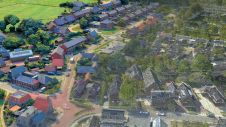
It took the Swiss Federal Office of Topography (Swisstopo) ten years to build an object-oriented topographic database in 3D, with the last objects having been completed in 2019. “Nothing is excluded now; everything you can think of is available in 3D. Even the administrative boundaries, which are legally not defined in 3D, are for practical reasons projected on the 3D terrain model,” states André Streilein, head of topography at Swisstopo. The difficulties and costs associated with the new data infrastructure were not caused by the third dimension, he says. “There was no specific 3D work. Since we already used photogrammetry, we were already measuring in three dimensions, only we never used the third dimension. The main effort was related to changing from a system of cartographic-based databases to a single topographic-based one. That was the real objective; we just incorporated the 3D element too.”Swisstopomigrated several legacy multi-scale databases into one high-resolution topographic landscape model comprising over 25 million uniquely referenced objects. This scale-independent database is maintained via orchestrated rule-based production workflows to enforce the highest levels of data quality and efficiency. “The main challenge for us over the past years has been the ‘degeneralization’. All the cartographic generalization had to be undone and the features of the objects had to be mapped just as they appear in reality. We now have everything at a degree of detail to allow the generation of 1:5,000 maps.” Most Swisstopo products (including 2D ones) and services are derived from that single topographic landscape model (TLM) and the corresponding 100%-consistent digital terrain model (DTM).
数据捕获和维护
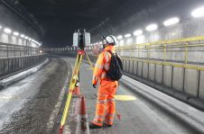
The coordinates of every vertex of all TLM objects are recorded in the same way nationwide with an accuracy of 20cm, except for features which are not defined at 20cm (such as forests). Every year, one third of the country is subject to remote sensing by aerial photogrammetry. Swisstopo uses Lidar and photogrammetry for the terrain and also for the surface models. Unmanned aerial vehicles and satellites are used for complementary up-to-date information in the areas that are not flown that year. Information collected by local authorities is also important input. Nothing is measured terrestrially any more. “Time is only spent on fieldwork if the photogrammetry processing employees have a specific query, such as: ‘Is this the right underground connection to an underpass?’. In that case, our field staff – who are not necessarily qualified surveyors – verify the situation in the field, armed with a copy of the database. They mostly only have to say yes or no.”

Nowadays, the main challenge for Swisstopo in the updating process is to shorten the update cycles. A new version of the total topographic database is formally released every year, and some parts are even updated more often. That does not mean there is a new version of every separate product in that frequency, even though everybody assumes that the data in digital maps is both up to date and correct. “In our TLM, the ‘Verified’ label is the only guarantee of 100% quality and correctness,” says Streilein. “The local authorities inform us whenever they start work on infrastructure projects. That goes into our database with the label ’Under construction’. As soon as new or changed infrastructure is released by the authorities, it is in our database within the space of a week under the label ‘Built as planned’. The object appears in our aerial imagery a maximum of three years later and then it is labelled ‘Verified’.”
Government Currency
The Swisstopo website has more than 30,000 unique visitors per day, to access the topographic database, orthophotos, terrain data and geological information. All the geodata recorded by other governmental organizations is also published in the national geodata portal coordinated by Swisstopo. Furthermore, Swisstopo is of course involved in many projects. For the Federal Office for Environment, for example, they monitor glaciers or the vegetation development in areas that have suffered forest fires. Public-sector organizations have to pay for Swisstopo’s services in ‘government currency’. André Streilein explains: “We send them an indicative invoice. We do not want a situation in which government organizations have to make a profit by billing each other or have to use poor-quality data because they need to save money. But in Switzerland the government wants to ensure the cost awareness.”
Citizens can view the data for free, while the private sector has to pay real money. Swisstopo is required to generate a return of about 27% per year on the public investment. “Therefore, we license our data for commercial re-use. The licensing cost depends on the intensity of use by the companies. Basically it is based on trust, but they have to report back to us on how they used the data. We hardly ever have problems with companies trying to manipulate us.”
In Switzerland, the question ‘Why not use Google Maps?’ is not uncommon. “The answer is not only that our work is more precise, but also that we are unbiased by commercial or political interests, which is the main value. You can trust it. It’s not like a Google search, in which you get different results depending on what kind of hardware you use or your location or the time of day. This ‘Google Maps’ question is less common in the public sector. Most Swiss politicians understand that, in this day and age, the federal geographic data infrastructure is as important as the infrastructure of highways or railways and that the state has to have full control of these databases, from content to quality assurance.”

好处
Around 15 years ago, before the creation of the TLM, Swisstopo sent out questionnaires across Switzerland, asking ‘What do you need in 3D?’. It received almost zero response. Now that the products are in use, the customers are generally pleased and are better able to indicate what else they want. Users are discovering that they can do things that were not possible with 2D data. Architects can integrate 3D data with their BIM data, road authorities can directly include the steepness percentage in their calculations, ‘smart city’ applications need 3D, and so on. “The financial benefits are huge for the country as a whole. And ultimately it’s about how we survive as a society,” comments Streilein. For example, Switzerland wants to have pulled out from nuclear energy by 2050, so the Federal Office of Energy needs to stimulate solar energy. In conjunction with them and with the Meteorological Office, Swisstopo made a太阳能肉上基于3D屋顶数据(屋顶是TLM中的单独对象),并在其周围构建了Web应用程序。这使人们能够看到他们在特定情况下投资太阳能电池板是否值得注意。他们可以从应用程序中分享输出 - 一个PDF,指定面板的类型和数量,屋顶上的位置,成本,投资回报等 - 使用安装公司,然后使用它申请其当地政府进行补贴。自该解决方案推出以来,瑞士太阳能电池板装置的数量已经飙升,因为它使公民更容易。
The existing IT infrastructure back in 2008 was insufficient to optimally share the benefits of all the data and services becoming available; something had to be done to create more computing capacity. Today, with approximately 80TB of data being exchanged with around 13 million customers per month and up to 3,000 map tiles delivered per second, cloud computing has proved to be the right choice. The capability to scale the solution (AWS从亚马逊)在几分钟内垂直和水平地导致过去10年同比增长50%,同时同时降低数据单元转移的成本。云的存储和传播数据的能力允许创建可以在近实时推送信息的产品。
No More Maps
On the topic of time, the next step is 4D. Every object in the database has a time stamp of when it came into existence and when it was entered into Swisstopo’s database. The first point is debatable, however. Take a new train tunnel, for example – does it come into existence upon physical completion, at the official opening ceremony, or the first time a train passes through it? Streilein admits: “This poses a new question for topographic institutes. We’ve chosen the moment to be when the railway company first uses it in its timetables.”
4D没有惊喜,而是一个国家映射机构在地图后思考'时代'。Swisstopo推出了一个项目,以更好地了解下一代将如何使用地理信息。“地图正在丢失其作为地理信息的发射机的角色,”他说。“我们更老的人了解地图,因为我们学会在学校使用它们,就像童子军,在军队等。今天的年轻人使用基于GPS的本地化信息并希望看到现实的图像。”因此,Swisstopo正在投资增强现实,以便使用智能手机或其他设备的人们只会在其屏幕上看到实际图像以及所需的数据。今天,仍然可以看到底层地图,但在未来的用户中,将要求他们所在的位置和/或想要去的位置般的图像以及他们需要的信息与有关对象相关的组织。某些联邦空间数据基础架构数据集目前正在转换为链接数据,因此每个对象都将具有唯一的资源标识符(URI)。不同的组织可以与它连接,用户在一个搜索中从不同来源获得(实时)信息。“原则上的数据库不是问题。但我们必须将数据库转换为未来用户需求的产品。 That’s the challenge!” concludes André Streilein.

关于Swisstopo和AndréStreilein
Swisstopo是瑞士联邦地板办公室,是瑞士国家映射机构,欧洲核心的山区,涵盖了41,285公里的总面积2(15,940 square miles). The agency plays a vital role as Switzerland’s geoinformation centre by collecting, managing and publishing official spatial data. Swisstopo measures, records and documents Switzerland’s landscape and underground structure. It is renowned worldwide for the quality and accuracy of its maps. Other significant offerings include altitude and landscape models, aerial photographs, orthophotos, geological data and maps, as well as internet and mobile applications such as the Swiss Federal Government’s map viewer:map.geo.admin.ch.。
Dr André Streilein是瑞士瑞士瑞士联邦地质办公室的地形部长。在他加入Swisstopo之前,他在摄影测量和遥感领域的高级研究员和助理教授工作了几年ETH Zurich(瑞士)和TU Delft(the Netherlands). He has a long-standing history in senior positions within various national and international organizations and served as vice-president research of European Spatial Data Research (EuroSDR).


