没有统计数据可以将能源的重要性传达给我们的经济和日常生活。几乎所有人每天与之互动的一切都具有力量来源。如果没有大量的发展,运输和农业的能量,任何国家都是不可能的。
(这个故事是由您带给您的European Space Imaging)
We currently sit at the crossroads between fossil fuels, renewables, rapid development and increasing safety and environmental concerns. New tools and techniques are being developed daily to better produce energy as well as efficiently monitor and protect current sources. Analysing tremendous amounts of new and degrading infrastructure requires tremendous amounts of updated reliable data.
With pipeline and electrical corridors stretching across vast expanses of land, city-sized solar farms and supply chains that demand ever-increasing security, Location Intelligence (LI) has become one of the biggest tools in the arsenal of energy companies. There is a strong demand for monitoring energy infrastructure in order to solve the most pressing challenges faced by the energy industry. Near real-time monitoring of both wide areas and specific locations has become crucial to analyse the markets as a whole and react to potentially damaging events.

Very High Resolution (VHR) optical satellite imagery can be an essential tool to monitor critical infrastructure like oil pipelines as it offers recurrent information from both a local and global scale. By combining data sources with artificial intelligence and machine learning, further insights can be gained autonomously and in a timelier manner. Advances in these technologies are becoming more affordable for most users, making the exploitation of remote sensing reliable and profitable.
其他领域,VHR光学卫星图像可以提供好处,包括侵占监测,植被控制,环境影响,现场勘探和能源市场评估。以下文章将概述能源行业如何从使用VHR卫星图像中受益。
测量石油库存
可能是唯一比石油更有价值的商品是关于石油市场的可靠数据。卫星图像不仅可以用来绘制生产设施中的绘制,监视和跟踪活动,还可以用令人难以置信的准确性来测量实际库存。
原油通常存储在大圆柱形容器中,屋顶漂浮在油顶上。立体VHR卫星图像可用于确定单个浮动屋顶的高度,因此可以进行简单的计算。该数据在能源市场投机中具有巨大的价值。
能源供应中断危机管理
2019年9月14日,在空袭期间,沙特阿拉伯的两个能源基础设施遭到袭击。这是最近历史上最大的石油供应中断之一。但是,市场仍然相对稳定,并很快回弹,这在很大程度上要感谢卫星图像。
袭击发生后第二天收集了很高的分辨率卫星图像,允许分析师检查损害赔偿并验证沙特阿美石油公司的索赔。在接下来的几周中,收集了更多图像,以跟踪修复进度和计算库存水平。
这level of detail contained in VHR satellite imagery verified that significant portions of the damage were superficial and were able to be easily repaired. Satellite imagery also made it possible to monitor activity at back up oil and gas facilities to ensure uninterrupted supplies. Due to competent crisis management efforts aided by near real-time monitoring with satellite imagery, speculators were able to effectively react to the disruption without overreacting.

Vegetation Management
植被侵占是公用事业提供商面临的主要后勤挑战之一,导致严重的停电以及阻碍维护和紧急维修工作。
Multispectral stereo VHR satellite imagery allows users to map the height, density and type of plants within power line corridors at significant savings compared to aerial and on-site inspections. As chemical herbicide regulations tighten around Europe, frequent monitoring of problem areas and validation of completed trimming become increasingly necessary.

保护管道
第三方干预(TPI)仍然是全球管道失败的主要原因。石油和天然气管道事故往往是影响公共安全,环境保护和整个能源市场的高影响事件。
Industry leaders are constantly looking for new and innovative techniques for monitoring pipeline Right of Ways (RoW). Advancements in satellite imagery and artificial intelligence allow asset managers to monitor entire stretches of pipelines from their desk. Very High Resolution satellite imagery is integrated seamlessly into tailored made mapping and advanced detection software so users can monitor changes in the activity and structures near pipeline corridors.
30厘米分辨率卫星图像提供的细节水平使用户可以识别和跟踪潜在的危害,例如重型建筑设备。这可以帮助有效地以比空中检查和现场检查低得多的成本部署人员和资源。
Renewables
太阳能和风能等可再生资源的增长令人难以置信的增长,这并不震惊。随着这些技术的发展和传播,遥感技术也具有支持它们。
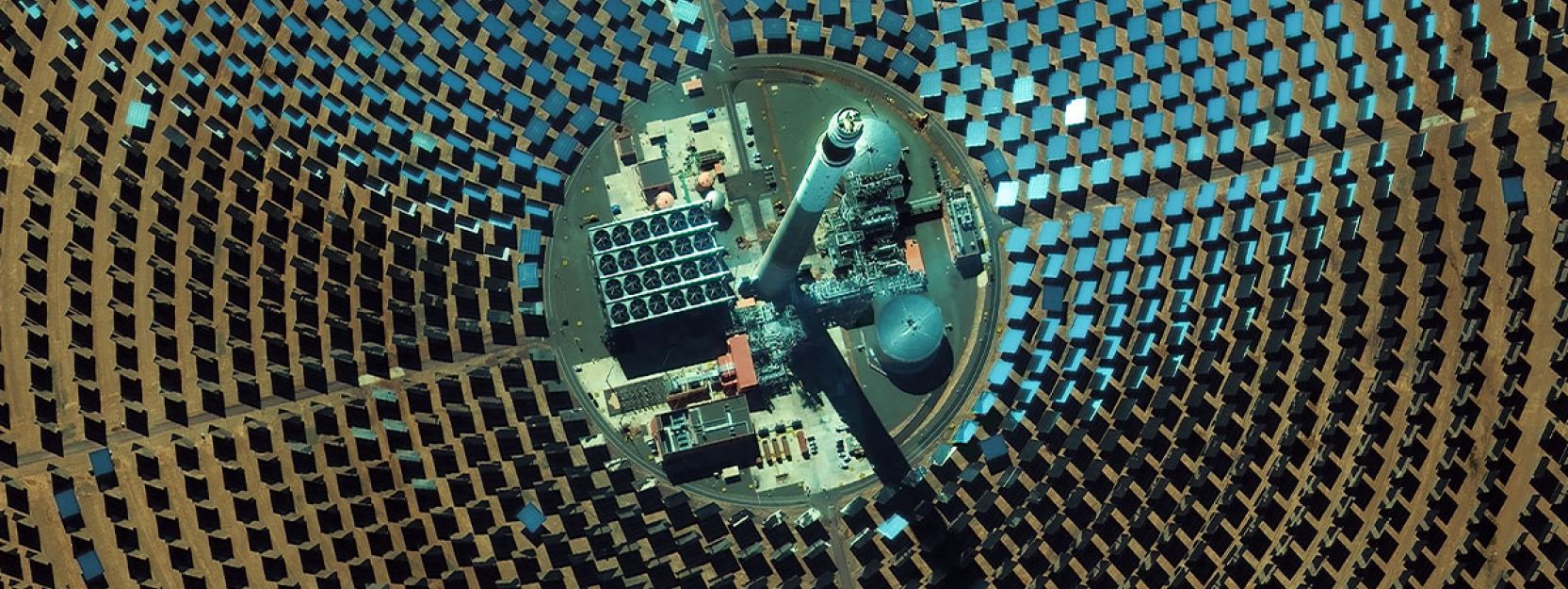
VHR卫星图像广泛用于太阳能行业,用于监测大型,城市大小的太阳能农场以及自动检测房屋和建筑物上的太阳能电池板。风能行业使用卫星图像来绘制离岸农场的水深和沙杆,并从桌面验证螺旋桨的方向。

Planning New Energy Infrastructure
这“Paris Agreement” has created the need for expanded renewable energy infrastructure across Europe. The conventional methods of site selection and planning using registry office maps, manual inspections and aerial photos cannot keep up. Cutting edge methods for efficient site selection and planning that utilize satellite imagery in combination with Artificial Intelligence (AI) and big data processing are currently underway.
这德国航空航天中心(DLR) as well as many other Earth observation and data analytics organizations are aiming to develop processes for finding the ideal locations for new energy infrastructure across the continent. Some of these new highly automated approaches utilizing VHR satellite imagery include:
- 根据当前的土地使用图检测合适的基础设施站点
- Wind pattern analysis for projected wind farms
- 阴影与太阳能农场的阳光评估
- Calculations for total rooftop areas available for solar panels
European Space Imaging在建筑,工程和建设中,与许多当局和私人公司紧密合作有15年以上的经验。188asia备用网址无论是交付档案数据还是计划新鲜收购,该团队都可以帮助各种城市规划申请,以确保达到计划目标。

