无人机民事Infr检查astructure
UAVs with a higher level of autonomy can make civil engineering inspections safer, faster and more accurate, plus they support the monitoring of infrastructural changes over time....

UAVs with a higher level of autonomy can make civil engineering inspections safer, faster and more accurate, plus they support the monitoring of infrastructural changes over time....

Are you thinking about using drones for land administration projects, but don't know where to start? Read on for advice from our specialists. For our ‘Ask the Specialist&rsqu...

Lidar mapping based on unmanned aerial vehicles (UAVs or ‘drones’) can generally be thought of as a close-range version of manned airborne laser scanning. In brief, low...

Atmos UAV recently announced the appointment of René Worms as its head of global sales. Worms, a well-known strategist and geospatial expert, will work on the international...
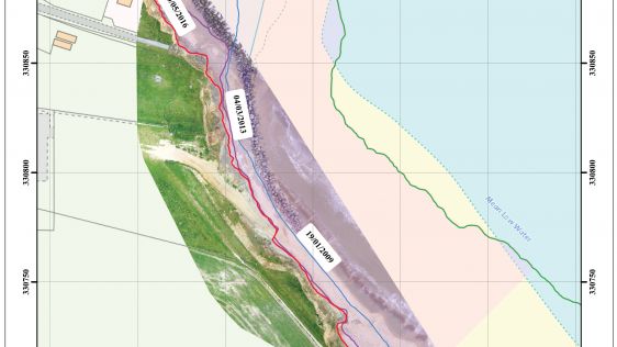
UAS (Unmanned Airborne Systems) are rapidly becoming a valuable source of data for inspection, surveillance, mapping and 3D modelling projects. Investment in the commercial UAS ind...
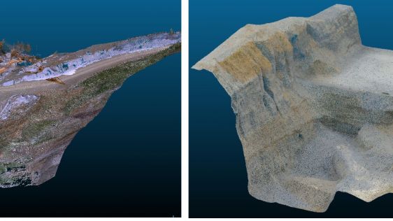
Are photogrammetric point clouds superior to Lidar point clouds, or is it the other way around? To address this topic of ongoing debate, the authors of this article conducted a ter...

When disaster strikes, the courage and experience of rescue task forces is put to the test. They face heading into the unknown every time they enter a terrain during a rescue missi...
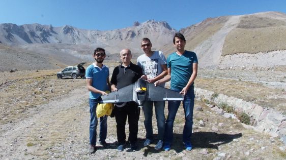
High mountains are attractive places for outdoor sports. However, sometimes they change from recreational areas into hazardous ones. All year round, falling rocks and landslides en...

Monitoring crop growth provides timely and reliable spatial information to farmers and decision-makers employed in precision agriculture. The authors of this article tested the usa...
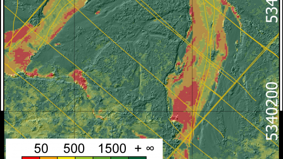
The development of lightweight, survey-grade Lidar sensors has made it possible to equip unmanned aerial systems (UASs) with very precise laser scanners, thus opening up new possib...

This was the fourth year the UK Commercial UAV Show was held in the ExCeL Centre, London, UK, and for the first time, this year was moved from the month of October to 15-16 Novembe...

If vegetation comes into direct contact with power lines it can cause service disruption, not to mention fires or even electrocutions. To avoid such undesirable consequences, most...
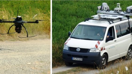
3D mapping of roads, pipelines and other linear structures – often called corridors – is an important geomatics activity. Geodata acquisition technologies, which are in...

Unmanned aerial vehicles (UAVs or ‘drones’) have become an essential tool for land surveyors. The geospatial industry is turning to drones to map the environment, which...

Unmanned aerial systems (UASs) include imaging systems and/or airborne Lidar systems on an ever-increasing number of variously sized, remotely piloted fixed-wing or multi-propeller...
Do you have an interesting idea for an article in188金宝搏特邀? We are always looking for the best news and views from the geomatics industry. If you are working with the most innovative technology, have performed a challenging survey or simply want to share your perspectives on the future, please send an email to our content manager, Wim van Wegen:wim.van.wegen@geomares.nl. He will be more than happy to explore ways of sharing your ideas with your peers throughout the geomatics world.
This site uses cookies. By continuing to use this website, you agree to ourCookies Policy.Agree